Níger · Campo volcánico
Todra Volcanic Field
- Tipo
- Campo volcánico
- Altitud
- 1780 m
- Última erupción
- Desconocido
- Tipo
- Campo volcánico
- País
- Níger
- Región
- África del Norte / West Central Sahara Volcanic Province
- Altitud
- 1780 m
- Coordenadas
- 17.680, 8.500
- Última erupción
- Desconocido
- Contexto tectónico
- Intraplaca / Corteza continental (> 25 km)
- Forma volcánica
- Grupo volcánico
- Roca principal
- Basalto / Picrobasalto
Resumen geológico
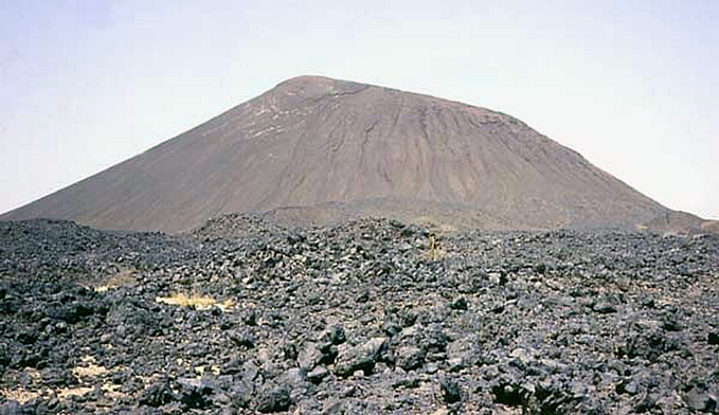
The Todra Volcanic Field covers about 1,000 km2 in the Tuareg shield in the southern Aïr region of Niger. Activity began with the eruption of about 30 trachytic and phonolitic volcanoes through Precambrian basement rocks. This was followed by the formation of about 130 basaltic cones that typically produced valley-filling lava flows. A series of NW-SE faults control cone locations. The date of the latest eruption is not known, but may have been as recent as a few centuries ago.
Historial de erupciones
GlosarioLínea de tiempo detallada
No hay registros de erupciones disponibles.
Volcanes cercanos
Enlaces externos
⚠ Solo como referencia. No apto para respuesta ante emergencias.