Papúa Nueva Guinea · Volcán complejo
St. Andrew Strait
- Tipo
- Volcán complejo
- Altitud
- 270 m
- Última erupción
- 1957
- Tipo
- Volcán complejo
- País
- Papúa Nueva Guinea
- Región
- Pacífico Suroccidental / Bismarck Sea Volcanic Province
- Altitud
- 270 m
- Coordenadas
- -2.380, 147.350
- Última erupción
- 1957
- Contexto tectónico
- Zona de subducción / Corteza oceánica (< 15 km)
- Forma volcánica
- Compuesto
- Roca principal
- Riolita
Resumen geológico
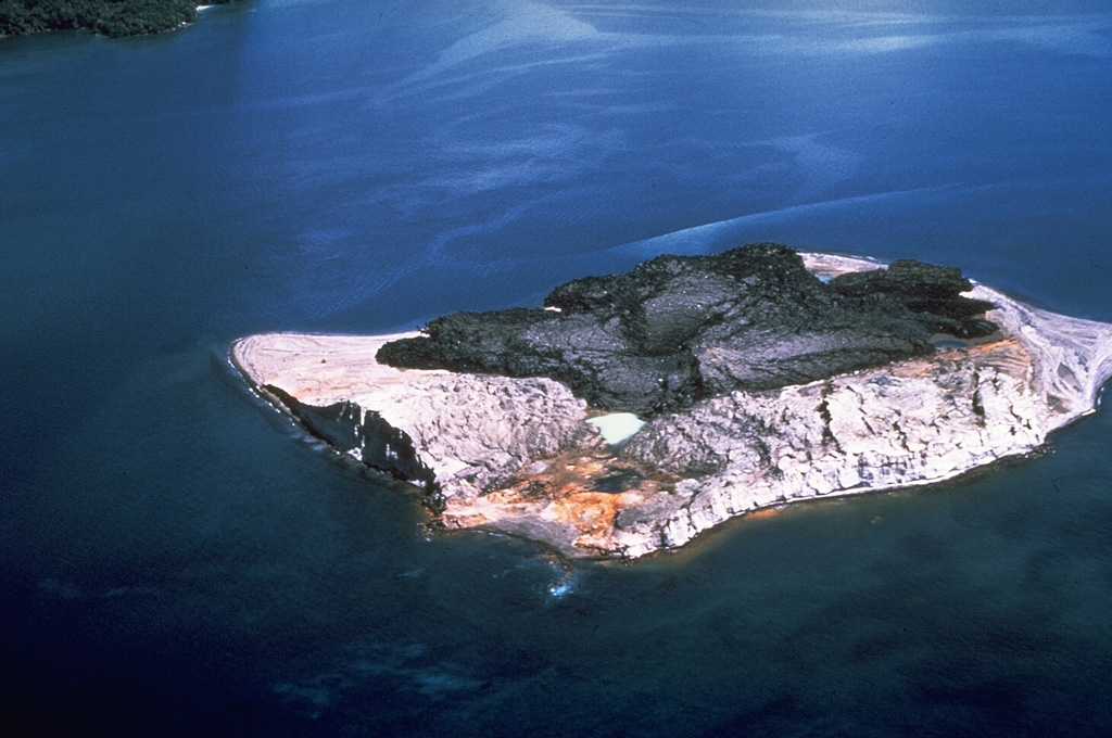
The St. Andrew Strait volcano, located in the Admiralty Islands north of Papua New Guinea, consists of a series of overlapping Quaternary cones formed by rhyolitic lava flows and pyroclastic materials on Lou and Tuluman Islands. Volcanism is aligned on a curved arc extending through the 12-km-long Lou Island. The Tuluman Islands, 1.5 km S of Lou Island, were formed during a 1953-1957 eruption. Pam Lin and Pam Mandian Islands farther to the SE along the same arc contain fresh rhyolitic obsidian similar to that found on Tuluman.
Historial de erupciones
5 registradasGlosarioResumen (VEI en el tiempo)
Haga clic en una barra para ver erupciones individuales · Usa las flechas para moverte entre barras y Enter para abrir
Línea de tiempo detallada
- 1953VEI 2Observado1953-06-27 – 1957-01-28Tuluman
- 1931VEI 0Método no indicado1931-07-02 – fin desconocidoTuluman (?)
- 1883VEI 2Observado1883-03-28 – fin desconocidoTuluman
- 350VEI ?Estimación geológica350 – fin desconocidoLou Island (Bedal volcano)
- 240 a. C. (±100 años)VEI ?Estimación geológica240 a. C. – fin desconocidoLou Island (Bedal volcano)
Volcanes cercanos
Enlaces externos
⚠ Solo como referencia. No apto para respuesta ante emergencias.