Papúa Nueva Guinea · Campo volcánico
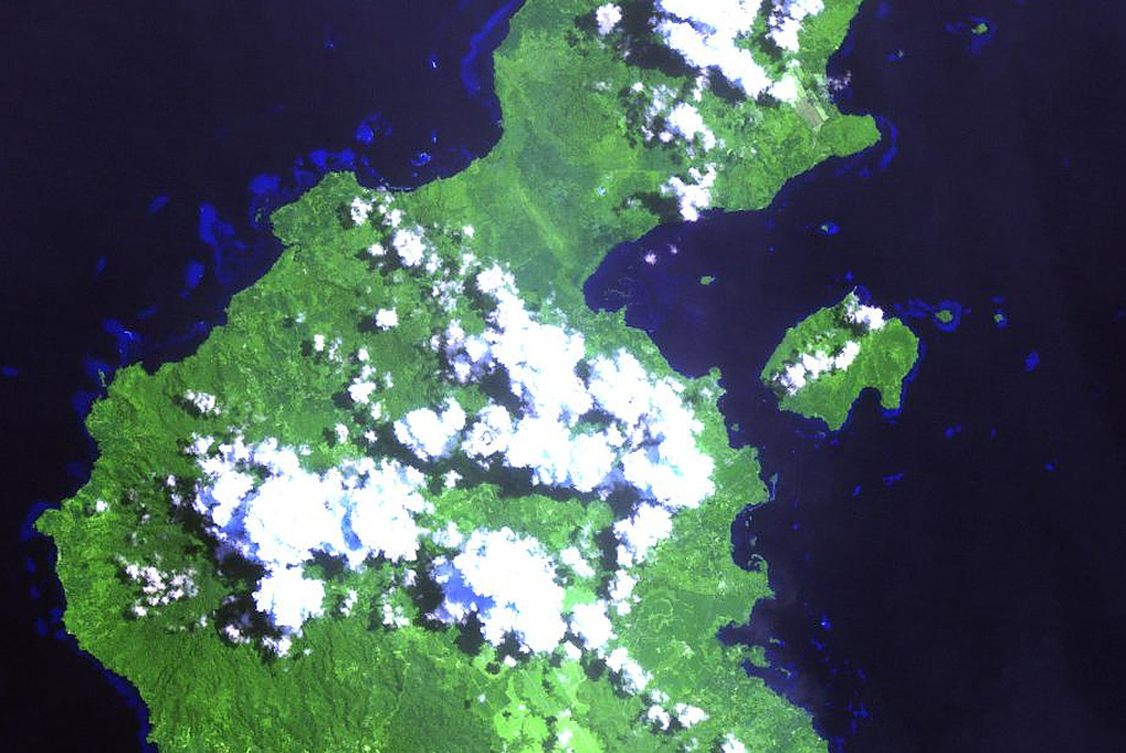
Garua Harbour
- Tipo
- Campo volcánico
- Altitud
- 565 m
- Última erupción
- Desconocido
- Tipo
- Campo volcánico
- País
- Papúa Nueva Guinea
- Región
- Pacífico Suroccidental / Bismarck Volcanic Arc
- Altitud
- 565 m
- Coordenadas
- -5.300, 150.070
- Última erupción
- Desconocido
- Contexto tectónico
- Zona de subducción / Corteza continental (> 25 km)
- Forma volcánica
- Grupo volcánico
- Roca principal
- Riolita
Resumen geológico
The Garua (Talasea) Harbour volcanic field consists of a group of lava domes and ash cones of possible Holocene age. These volcanic vents ring the harbor on the west and form Garua Island to the east. Much of the volcanic field, including the two lava domes on Garua Island, consists of rhyolitic rocks. Active hot springs ring the shores of Garua Harbour and are best developed on the north and south sides. Large boiling pools, fumaroles, and small geysers are found on the north shore near Pangalu village. Another large group of boiling pools, fumaroles, and mudpots is located near the Talasea Government Station on the south shore of the bay.
Historial de erupciones
GlosarioLínea de tiempo detallada
No hay registros de erupciones disponibles.
Volcanes cercanos
Enlaces externos
- Todavía no está en Wikipedia (Español). Puede contribuir en Wikidata.
- Página original del Smithsonian GVP
⚠ Solo como referencia. No apto para respuesta ante emergencias.