Indonesia · Caldera
Wai Sano
Sano, Wai
- Tipo
- Caldera
- Altitud
- 1319 m
- Última erupción
- Desconocido
- Tipo
- Caldera
- País
- Indonesia
- Región
- Sunda y Banda / Sunda Volcanic Arc
- Altitud
- 1319 m
- Coordenadas
- -8.735, 120.007
- Última erupción
- Desconocido
- Contexto tectónico
- Zona de subducción / Corteza continental (> 25 km)
- Forma volcánica
- Compuesto
- Roca principal
- Dacita
Resumen geológico
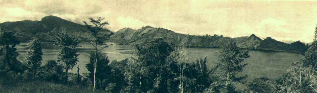
The Wai Sano composite volcano at the western end of Flores Island includes a 2.5 x 3.5 km elliptical caldera in the NW part of a larger 9-10 km edifice. The caldera contains Sanonggoang Lake, with a surface more than 200 m below the high point on the southern caldera rim. The Poco Sesok and Poco Dedeng peaks are near the center of the eroded massif. The area has been a target of geothermal investigations, and two solfataras are located at the SE shore of the lake. No eruptions have been reported or dated, but the area was mapped as Holocene (Ratman and Yasin, 1978).
Resumen de Wikipedia
Resumen en inglésWai Sano is a volcano located in the western part of the island of Flores, Indonesia. Wai Sano consists of an elliptical caldera about one mile (2.5 km) wide, containing a lake 260 meters below the 903 meter caldera rim, itself part of Mount Umpu Rua. Two fumaroles are located on the southeastern shore of the lake. No historical eruptions are known.
Wikipedia · CC BY-SA · Leer artículo completo →
Historial de erupciones
GlosarioLínea de tiempo detallada
No hay registros de erupciones disponibles.
Volcanes cercanos
Enlaces externos
⚠ Solo como referencia. No apto para respuesta ante emergencias.