Japón · Estratovolcán
Kita-Fukutokutai
- Tipo
- Estratovolcán
- Altitud
- 73 m (submarino)
- Última erupción
- 1954
- Tipo
- Estratovolcán
- País
- Japón
- Región
- Pacífico Noroccidental / Ogasawara Volcanic Arc
- Altitud
- 73 m (submarino)
- Coordenadas
- 24.417, 141.417
- Última erupción
- 1954
- Contexto tectónico
- Zona de subducción / Espesor de corteza desconocido
- Forma volcánica
- Compuesto
- Roca principal
- Sin datos
Resumen geológico
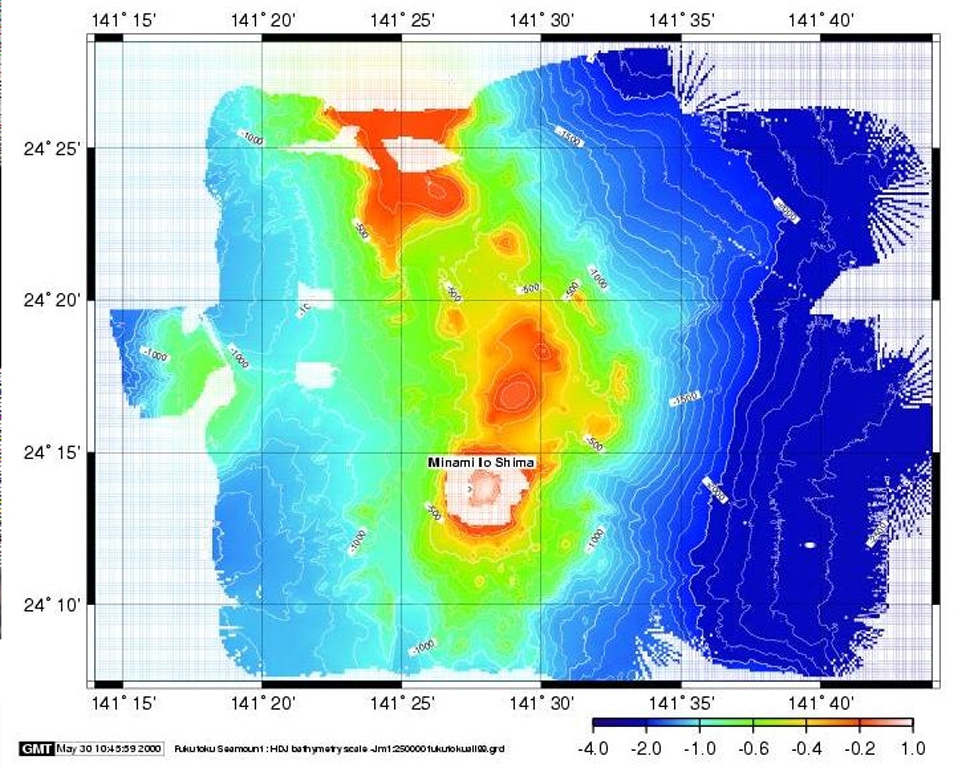
Kita-Fukutokutai is a submarine volcano halfway between the Ioto and Minami-Ioto islands. The volcano rises to within 73 m of the ocean surface. Water discoloration was reported several times beginning in 1937, and floating pumice was seen during 1953-54. In 1988 a fishing boat reported an eruption column about 100 m high, although the report was not confirmed at the time. The Japan Meteorological Agency has classified Kita-Fukutokutai as an active volcano.
Historial de erupciones
6 registradasGlosarioResumen (VEI en el tiempo)
Haga clic en una barra para ver erupciones individuales · Usa las flechas para moverte entre barras y Enter para abrir
Línea de tiempo detallada
- 2001VEI 0Método no indicado2001-10-30 – 2001-10-3024.443 N, 141.378 E
- 1988VEI 1Método no indicado1988-01-27 – fin desconocido
- 1959VEI 0Método no indicado1959-07-02 – fin desconocido
- 1953VEI 0Observado1953-07-02 – 1954-07-02
- 1947VEI 0Método no indicado1947-07-02 – fin desconocido
- 1937VEI 0Método no indicado1937-07-02 – fin desconocido
Volcanes cercanos
Enlaces externos
- Todavía no está en Wikipedia (Español). Puede contribuir en Wikidata.
- Página original del Smithsonian GVP
⚠ Solo como referencia. No apto para respuesta ante emergencias.