China · Campo volcánico
Honggeertu volcanic field
Honggeertu
- Tipo
- Campo volcánico
- Altitud
- 1605 m
- Última erupción
- Desconocido
- Tipo
- Campo volcánico
- País
- China
- Región
- Asia Oriental / Central East Asia Volcanic Province
- Altitud
- 1605 m
- Coordenadas
- 41.590, 113.111
- Última erupción
- Desconocido
- Contexto tectónico
- Intraplaca / Corteza continental (> 25 km)
- Forma volcánica
- Grupo volcánico
- Roca principal
- Basalto / Picrobasalto
Resumen geológico
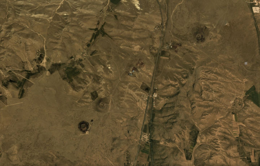
The Honggeertu volcanic field is located in Nei Mongol Province, NW of Beijing. The basaltic volcanic field consists of a group of six cinder cones extending along an arc for about 10 km that were considered to be of Holocene age by IAVCEI (1973). Liu (1998, p.c.), however, considered the existence of Holocene volcanism at this location to be uncertain.
Historial de erupciones
GlosarioLínea de tiempo detallada
No hay registros de erupciones disponibles.
Volcanes cercanos
Enlaces externos
⚠ Solo como referencia. No apto para respuesta ante emergencias.