Estados Unidos · Campo volcánico
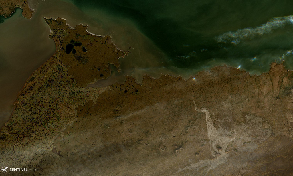
St. Michael volcanic field
St. Michael
- Tipo
- Campo volcánico
- Altitud
- 715 m
- Última erupción
- Desconocido
- Tipo
- Campo volcánico
- País
- Estados Unidos
- Región
- América del Norte / Northern Alaska-Bering Sea Volcanic Province
- Altitud
- 715 m
- Coordenadas
- 63.450, -162.120
- Última erupción
- Desconocido
- Contexto tectónico
- Intraplaca / Corteza continental (> 25 km)
- Forma volcánica
- Grupo volcánico
- Roca principal
- Basalto / Picrobasalto
Resumen geológico
The St. Michael volcanic field, at the south end of Norton Sound, includes more than 55 cones and craters on St. Michael and Stuart islands. Broad low shield volcanoes underlie the younger cones, and maars are located at the SW part of the field, which covers over 3,000 km2 and extends inland along the Golsovia and Kogok rivers. The youngest activity is of Holocene age, and native tradition says that a village was submerged by lava three times (Dall, 1870).
Resumen de Wikipedia
Resumen en inglésThe St. Michael volcanic field is a volcanic field located on St. Michael and Stuart Islands in western Alaska, United States. It contains 55 cones and craters, including low broad shield volcanoes and maars. It is considered part of the Bering Sea Volcanic Province.
Wikipedia · CC BY-SA · Leer artículo completo →
Historial de erupciones
GlosarioLínea de tiempo detallada
No hay registros de erupciones disponibles.
Volcanes cercanos
Enlaces externos
⚠ Solo como referencia. No apto para respuesta ante emergencias.