Estados Unidos · Volcán en escudo
Black Butte Crater Lava Field
- Tipo
- Volcán en escudo
- Altitud
- 1478 m
- Última erupción
- -8180
- Tipo
- Volcán en escudo
- País
- Estados Unidos
- Región
- América del Norte / Yellowstone-Snake River Hotspot Volcano Group
- Altitud
- 1478 m
- Coordenadas
- 43.185, -114.354
- Última erupción
- -8180
- Contexto tectónico
- Zona de rift / Corteza continental (> 25 km)
- Forma volcánica
- Escudo
- Roca principal
- Basalto / Picrobasalto
Resumen geológico
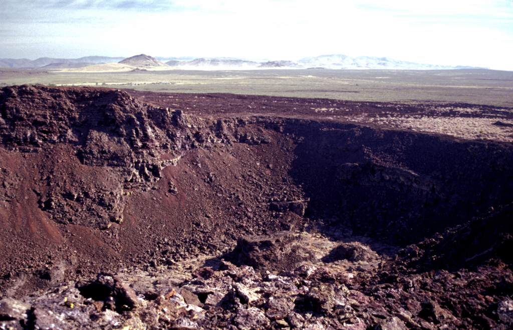
The Black Butte Crater lava field is the westernmost of the young lava fields of the Eastern Snake River Plain. It lies north of Twin Falls, Idaho, and created an L-shaped lava flow 2-5 km wide that extends 60 km S and then west. A single radiocarbon age of 10,130 +/- 350 years BP was obtained for lava flows here (Kuntz et al., 1986). Black Butte Crater caps a lava shield at the NE end of the flow field. The vent area contains a complex lava lake that forms a six-part flower-petal like depression with steep walls up to 30 m high that covers an area of 2 km2. A lava tube and channel system extending 5 km SE of the crater displays both roofed and collapsed portions. The Big Wood and Little Wood rivers follow the northern and southern margins of the distal part of the lava flow, respectively. The voluminous flow diverted the river channels so that they now join 40 km W of their former confluence.
Historial de erupciones
1 registradasGlosarioLínea de tiempo detallada
- 8180 a. C. (±350 años)VEI 0Estimación geológica8180 a. C. – fin desconocidoBlack Butte Crater
Volcanes cercanos
Enlaces externos
- Todavía no está en Wikipedia (Español). Puede contribuir en Wikidata.
- Página original del Smithsonian GVP
⚠ Solo como referencia. No apto para respuesta ante emergencias.