México · Campo volcánico
Chichinautzin
- Tipo
- Campo volcánico
- Altitud
- 3938 m
- Última erupción
- 399
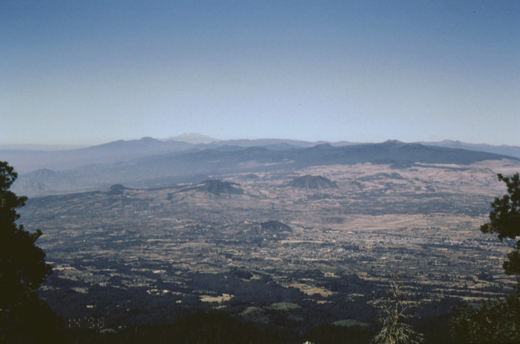
- Tipo
- Campo volcánico
- País
- México
- Región
- América Central y Caribe / Trans-Mexican Volcanic Arc
- Altitud
- 3938 m
- Coordenadas
- 19.139, -99.160
- Última erupción
- 399
- Contexto tectónico
- Zona de subducción / Corteza continental (> 25 km)
- Forma volcánica
- Grupo volcánico
- Roca principal
- Andesita / Andesita basáltica
Resumen geológico
The massive Chichinautzin volcanic field extends over an 88 km E-W area immediately south of Mexico City. The Sierra Chichinautzin, formed primarily of overlapping small cinder cones and shield volcanoes, creates a broad topographic barrier at the southern end of the Basin of Mexico that extends from the E flank of Nevado de Toluca to the W flank of Iztaccíhuatl. The volcanic field contains more than 220 Pleistocene-to-Holocene monogenetic vents. The best-known eruption occurred about 1,670 radiocarbon years ago (400 CE) from the Xitle scoria cone, NE of the Volcán Ajusco lava dome complex, which forms the highest peak of the Sierra Chichinautzin. The Xitle eruption produced a massive basaltic tube-fed lava flow that covered agricultural lands as well as pyramids and other structures of Cuicuilco and adjacent prehispanic urban centers. The southern part of Mexico City and the National University of México lie atop the distal end of the 13-km-long lava flow.
Resumen de Wikipedia
Resumen en inglésThe Sierra Chichinautzin volcanic field, also known as El Pedegral, is located in the Trans-Mexican Volcanic Belt, approximately 350 kilometres (220 mi) from where the Cocos Plate subducts beneath the North American Plate.
Wikipedia · CC BY-SA · Leer artículo completo →
Historial de erupciones
8 registradasGlosarioLínea de tiempo detallada
- 399 (±149 años)VEI 3Estimación geológica399 – fin desconocidoXitle
- 203 (±131 años)VEI 3Estimación geológica203 – fin desconocidoChichinautzin
- 2238 a. C. (±1413 años)VEI 3Estimación geológica2238 a. C. – fin desconocidoGuespalapa
- 4250 a. C. (±75 años)VEI 3Estimación geológica4250 a. C. – fin desconocidoTláloc
- 5840 a. C. (±500 años)VEI ?Estimación geológica5840 a. C. – fin desconocidoCuauhtzin
- 7340 a. C. (±1050 años)VEI 0Estimación geológica7340 a. C. – fin desconocidoCerro Tetepetl
- 7370 a. C. (±300 años)VEI 4Estimación geológica7370 a. C. – fin desconocidoTres Cruces
- 7930 a. C. (±500 años)VEI 3Estimación geológica7930 a. C. – fin desconocidoVolcán Pelado
Volcanes cercanos
Enlaces externos
⚠ Solo como referencia. No apto para respuesta ante emergencias.