Chile · Campo volcánico
Cayutué-La Viguería
Cayutue-La Vigueria
- Tipo
- Campo volcánico
- Altitud
- 506 m
- Última erupción
- -190
- Tipo
- Campo volcánico
- País
- Chile
- Región
- América del Sur / Southern Andean Volcanic Arc
- Altitud
- 506 m
- Coordenadas
- -41.300, -72.270
- Última erupción
- -190
- Contexto tectónico
- Zona de subducción / Corteza continental (> 25 km)
- Forma volcánica
- Grupo volcánico
- Roca principal
- Basalto / Picrobasalto
Resumen geológico
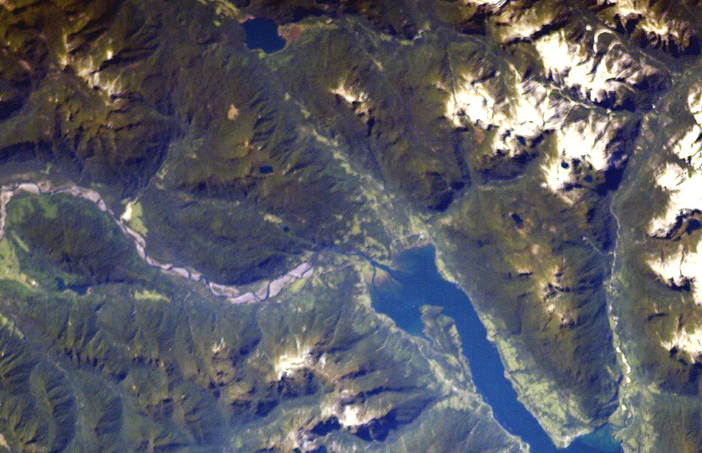
The Cayutué-La Viguería volcanic field consists of about 20 basaltic maars and cinder cones of Holocene age along the N-S-trending Liquiñe-Ofqui fault zone. The field occupies a low-lying area between the southern end of Ensenada Cayutué (the southern extension of Lake Todos los Santos) and the northern end of the Estuario Reloncaví. La Viguería and Volcán Cayutué are the principal cones. Formation of La Viguería and associated lava flows temporarily dammed the Río Petrohué about 3,000 years ago, forming an ephemeral lake that was filled with deposits from Calbuco and Osorno volcanoes. Pyroclastic cones and lava flows filled the Ensenada de Cayutué depression, separating Lake Todos los Santos from Ralún Bay.
Resumen de Wikipedia
Cayutué-La Viguería es un campo volcánico pequeño, que consta de una veintena de lagos y un maar, ubicado en la parte sur de Chile, a unos 70 km al noreste de Puerto Montt. Las formaciones volcánicas individuales están dispuestas a lo largo del sistema de fallas norte-sur. Las cuencas rocosas predominan en las formaciones rocosas. La última erupción ocurrió hace unos 3000 años.
Wikipedia · CC BY-SA · Leer artículo completo →
Historial de erupciones
1 registradasGlosarioLínea de tiempo detallada
- 190 a. C. (±190 años)VEI ?Estimación geológica190 a. C. – fin desconocidoLa Viguería
Volcanes cercanos
Enlaces externos
⚠ Solo como referencia. No apto para respuesta ante emergencias.