Chile · Campo volcánico
Meullin
- Tipo
- Campo volcánico
- Altitud
- 1080 m
- Última erupción
- Desconocido
- Tipo
- Campo volcánico
- País
- Chile
- Región
- América del Sur / Southern Andean Volcanic Arc
- Altitud
- 1080 m
- Coordenadas
- -45.220, -73.050
- Última erupción
- Desconocido
- Contexto tectónico
- Zona de subducción / Corteza continental (> 25 km)
- Forma volcánica
- Grupo volcánico
- Roca principal
- Basalto / Picrobasalto
Resumen geológico
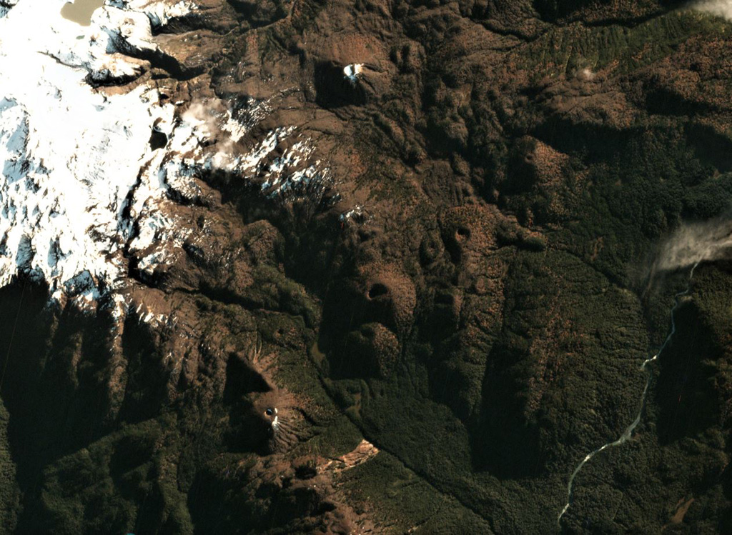
The Meullín volcanic field consists of a chain of well-preserved cinder cones along the Lago Meullín, Lago Yulton, Río Cuervo, and Quitralco fault segments of the regional Liquine-Ofqui fault zone. The cones straddle both sides of the Aisén (Aysén) Fjord and were considered to be of Holocene age (Vargas et al., 2013). The cinder cones, a few of which are sub-aquatic, extend to the south along NE-SW, NNE-SSW, and N-S lines from Yulton Lake. The largest concentration of cones lies between Meullín Lake and the older Pleistocene Meullín volcano located west of the volcanic field, and additional forested cinder cones were constructed along the Río Pescado valley south of Aisén Fjord.
Historial de erupciones
GlosarioLínea de tiempo detallada
No hay registros de erupciones disponibles.
Volcanes cercanos
Enlaces externos
- Todavía no está en Wikipedia (Español). Puede contribuir en Wikidata.
- Página original del Smithsonian GVP
⚠ Solo como referencia. No apto para respuesta ante emergencias.