Armenia · Kerucut piroklastik
Dar-Alages
Vaiyots-Sar
- Tipe
- Kerucut piroklastik
- Ketinggian
- 2575 m
- Letusan terakhir
- -2000
- Tipe
- Kerucut piroklastik
- Negara
- Armenia
- Wilayah
- Arab & Asia Tengah / Caucasus Volcanic Province
- Ketinggian
- 2575 m
- Koordinat
- 39.797, 45.497
- Letusan terakhir
- -2000
- Kondisi tektonik
- Intralempeng / Kerak benua (> 25 km)
- Bentuk lahan
- Kecil (basaltik)
- Batuan utama
- Andesit / Andesit basaltik
Ringkasan geologi
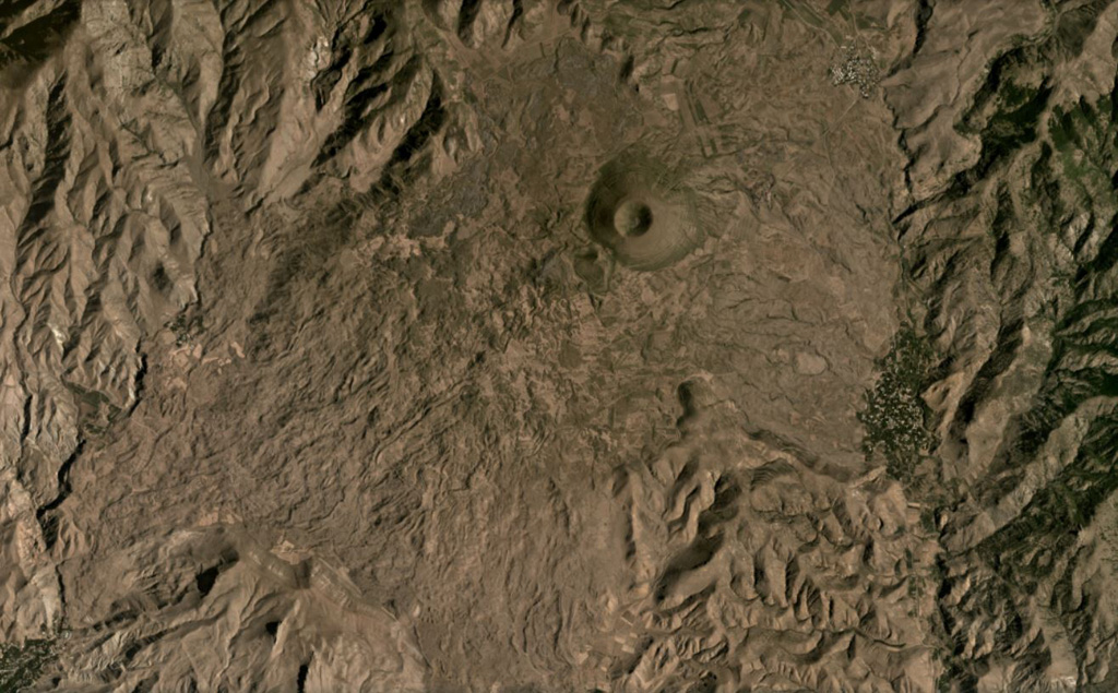
The Vaiyots-Sar pyroclastic cone is located in the southern Armenia province of Vayots Dzor in the western Vardenis Volcanic Highland south of Lake Sevan (Karakhanian et al., 2002); previous names such as Dar-Alages or Daly-Tapa are of Russian origin. Near the north end of the approximately 5 x 8 km flow field the 1.5-km-diameter cone rises about 300 m above the surrounding lavas, identified by Sviatlovsky (1959) as post-glacial. Oswald (1906) noted that steep escarpments of Nummulitic limestones were ~6 km NE of the cone across an lava-flow field. At the southern end of the flow field a fissure-fed lava flow several thousand years ago dammed the Arpah River near the town of Vyke and then flowed NW for 6 km; the flows overlie a late Pleistocene terrace and have little soil development (Karakhanian et al., 2002). The youthful-looking Smbatassar cinder cone, 17 km NW of Vaiyots-Sar, appears to be the source vent for Holocene lava flows that traveled 11 km N and 17 km S down two valleys (Karakhanian et al., 2002).
Ringkasan Wikipedia
Ringkasan InggrisDar-Alages is a group of six cinder lava cones south of Lake Sevan in Armenia. Fissure eruptions from Vaiyots-Sar dammed the Arpa river at Vayk and continued down the valley for 6 km. These lava flows are considered Holocene in age given the lack of a soil cover and their placement above a Pleistocene river terrace. Smbatassar cinder cones likewise generated two lava flows of 11 and 17 km length that overlie Pleistocene Yeheghis river terraces, thus also dating to the Holocene. Legends of the destruction of the towns Yegheghis and Moz in 735 AD may be linked to activity in these volcanoes.
Wikipedia · CC BY-SA · Baca artikel lengkap →
Riwayat letusan
2 tercatatGlosariumGaris waktu rinci
- 753VEI ?Metode tidak dinyatakan753 – akhir tidak diketahui
- 2000 SM (±1000 tahun)VEI ?Perkiraan geologi2000 SM – akhir tidak diketahuiVaiyots-Sar
Gunung api terdekat
Tautan eksternal
⚠ Untuk referensi saja. Bukan untuk tanggap darurat.