Kenya · Gunung api perisai
Barrier
Barrier, The
- Tipe
- Gunung api perisai
- Ketinggian
- 1032 m
- Letusan terakhir
- 1921
- Tipe
- Gunung api perisai
- Negara
- Kenya
- Wilayah
- Afrika Timur / Kenyan Rift Volcanic Province
- Ketinggian
- 1032 m
- Koordinat
- 2.320, 36.570
- Letusan terakhir
- 1921
- Kondisi tektonik
- Zona rift / Kerak benua (> 25 km)
- Bentuk lahan
- Perisai
- Batuan utama
- Trakit / Trakidasit
Ringkasan geologi
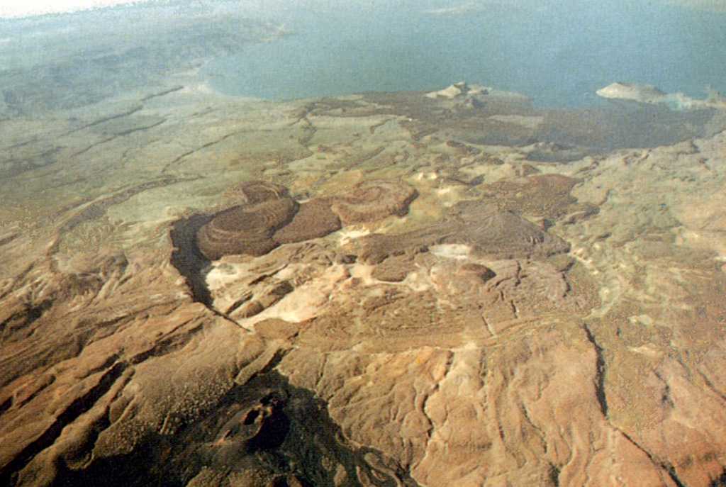
Teks asli bahasa InggrisThe Barrier volcanic complex separates Lake Turkana from the broad Suguta Trough to the S, the site of a former lake.
Kutipan dari Global Volcanism Program, Smithsonian Institution · Baca ringkasan lengkap di GVP →
Ringkasan Wikipedia
Ringkasan InggrisThe Barrier is an active shield volcano located in the north of Kenya.
Wikipedia · CC BY-SA · Lanjutkan membaca di Wikipedia bahasa Inggris →
Riwayat letusan
12 tercatatGlosariumRingkasan catatan
- Letusan terkonfirmasi
- 10
- Letusan tidak pasti
- 2
- Rentang catatan terkonfirmasi
- 7710 SM (±200 tahun) – 1921
- Letusan terkonfirmasi terbesar
- VEI 2 (1921, yang terbaru dari 5)
- Letusan terkonfirmasi sejak 1900
- 2
Ringkasan (VEI dari waktu ke waktu)
Klik pada bar untuk melihat letusan individu · Gunakan tombol panah untuk berpindah batang, Enter untuk membuka
Garis waktu rinci
- 1921VEI 2Teramati1921-12-31 – akhir tidak diketahuiNorth flank (Teleki)
- 1920 (±3 tahun)VEI ?Metode tidak dinyatakan1920-07-02 – akhir tidak diketahuiSouth flank (Andrew's Volcano)
- 1917VEI 2Teramati1917-07-02 – akhir tidak diketahuiAndrew's or Teleki's Volcanoes
- 1906VEI ?Metode tidak dinyatakan1906-07-02 – akhir tidak diketahuiAndrew's or Teleki's Cones
- 1897VEI 2Teramati1897-05-16 – akhir tidak diketahuiNorth flank (Teleki) and Likaiu
- 1895VEI 2Teramati1895-07-02 – akhir tidak diketahuiNorth flank (Teleki's Cone)
- 1888VEI 0Teramati1888-07-02 – akhir tidak diketahuiNorth flank (Teleki's Cone)
- 1871 (±3 tahun)VEI 2Teramati1871-07-02 – akhir tidak diketahuiNorth flank (Teleki's Cone)
- 1090 (±50 tahun)VEI 0Perkiraan geologi1090 – akhir tidak diketahuiNorth flank
- 1050 (±150 tahun)VEI 0Perkiraan geologi1050 – akhir tidak diketahuiNorth flank
- 1030 (±150 tahun)VEI 0Perkiraan geologi1030 – akhir tidak diketahuiNorth flank
- 7710 SM (±200 tahun)VEI ?Perkiraan geologi7710 SM – akhir tidak diketahuiNorth (Abili Agituk) and south flanks
Gunung api terdekat
Tautan eksternal
⚠ Untuk referensi saja. Bukan untuk tanggap darurat.