Indonesia · Kaldera
Wai Sano
Sano, Wai
- Tipe
- Kaldera
- Ketinggian
- 1319 m
- Letusan terakhir
- Tidak diketahui
- Tipe
- Kaldera
- Negara
- Indonesia
- Wilayah
- Sunda & Banda / Sunda Volcanic Arc
- Ketinggian
- 1319 m
- Koordinat
- -8.735, 120.007
- Letusan terakhir
- Tidak diketahui
- Kondisi tektonik
- Zona subduksi / Kerak benua (> 25 km)
- Bentuk lahan
- Komposit
- Batuan utama
- Dasit
Ringkasan geologi
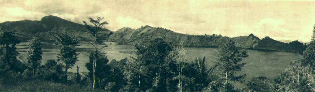
The Wai Sano composite volcano at the western end of Flores Island includes a 2.5 x 3.5 km elliptical caldera in the NW part of a larger 9-10 km edifice. The caldera contains Sanonggoang Lake, with a surface more than 200 m below the high point on the southern caldera rim. The Poco Sesok and Poco Dedeng peaks are near the center of the eroded massif. The area has been a target of geothermal investigations, and two solfataras are located at the SE shore of the lake. No eruptions have been reported or dated, but the area was mapped as Holocene (Ratman and Yasin, 1978).
Ringkasan Wikipedia
Ringkasan InggrisWai Sano is a volcano located in the western part of the island of Flores, Indonesia. Wai Sano consists of an elliptical caldera about one mile (2.5 km) wide, containing a lake 260 meters below the 903 meter caldera rim, itself part of Mount Umpu Rua. Two fumaroles are located on the southeastern shore of the lake. No historical eruptions are known.
Wikipedia · CC BY-SA · Baca artikel lengkap →
Riwayat letusan
GlosariumGaris waktu rinci
Tidak ada catatan letusan.
Gunung api terdekat
Tautan eksternal
⚠ Untuk referensi saja. Bukan untuk tanggap darurat.