Jepang · Stratovolkan
Kita-Fukutokutai
- Tipe
- Stratovolkan
- Ketinggian
- 73 m (bawah laut)
- Letusan terakhir
- 1954
- Tipe
- Stratovolkan
- Negara
- Jepang
- Wilayah
- Pasifik Barat Laut / Ogasawara Volcanic Arc
- Ketinggian
- 73 m (bawah laut)
- Koordinat
- 24.417, 141.417
- Letusan terakhir
- 1954
- Kondisi tektonik
- Zona subduksi / Ketebalan kerak tidak diketahui
- Bentuk lahan
- Komposit
- Batuan utama
- Tidak ada data
Ringkasan geologi
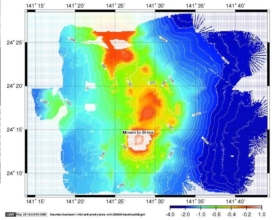
Kita-Fukutokutai is a submarine volcano halfway between the Ioto and Minami-Ioto islands. The volcano rises to within 73 m of the ocean surface. Water discoloration was reported several times beginning in 1937, and floating pumice was seen during 1953-54. In 1988 a fishing boat reported an eruption column about 100 m high, although the report was not confirmed at the time. The Japan Meteorological Agency has classified Kita-Fukutokutai as an active volcano.
Riwayat letusan
6 tercatatGlosariumRingkasan (VEI dari waktu ke waktu)
Klik pada bar untuk melihat letusan individu · Gunakan tombol panah untuk berpindah batang, Enter untuk membuka
Garis waktu rinci
- 2001VEI 0Metode tidak dinyatakan2001-10-30 – 2001-10-3024.443 N, 141.378 E
- 1988VEI 1Metode tidak dinyatakan1988-01-27 – akhir tidak diketahui
- 1959VEI 0Metode tidak dinyatakan1959-07-02 – akhir tidak diketahui
- 1953VEI 0Teramati1953-07-02 – 1954-07-02
- 1947VEI 0Metode tidak dinyatakan1947-07-02 – akhir tidak diketahui
- 1937VEI 0Metode tidak dinyatakan1937-07-02 – akhir tidak diketahui
Gunung api terdekat
Tautan eksternal
- Belum ada di Wikipedia (Bahasa Indonesia). Anda dapat berkontribusi di Wikidata.
- Halaman asli Smithsonian GVP
⚠ Untuk referensi saja. Bukan untuk tanggap darurat.