Amerika Serikat · Stratovolkan
South Sarigan Seamount
- Tipe
- Stratovolkan
- Ketinggian
- 184 m (bawah laut)
- Letusan terakhir
- 2010
- Tipe
- Stratovolkan
- Negara
- Amerika Serikat
- Wilayah
- Pasifik Barat Laut / Mariana Volcanic Arc
- Ketinggian
- 184 m (bawah laut)
- Koordinat
- 16.580, 145.780
- Letusan terakhir
- 2010
- Kondisi tektonik
- Zona subduksi / Ketebalan kerak tidak diketahui
- Bentuk lahan
- Komposit
- Batuan utama
- Tidak ada data
Ringkasan geologi
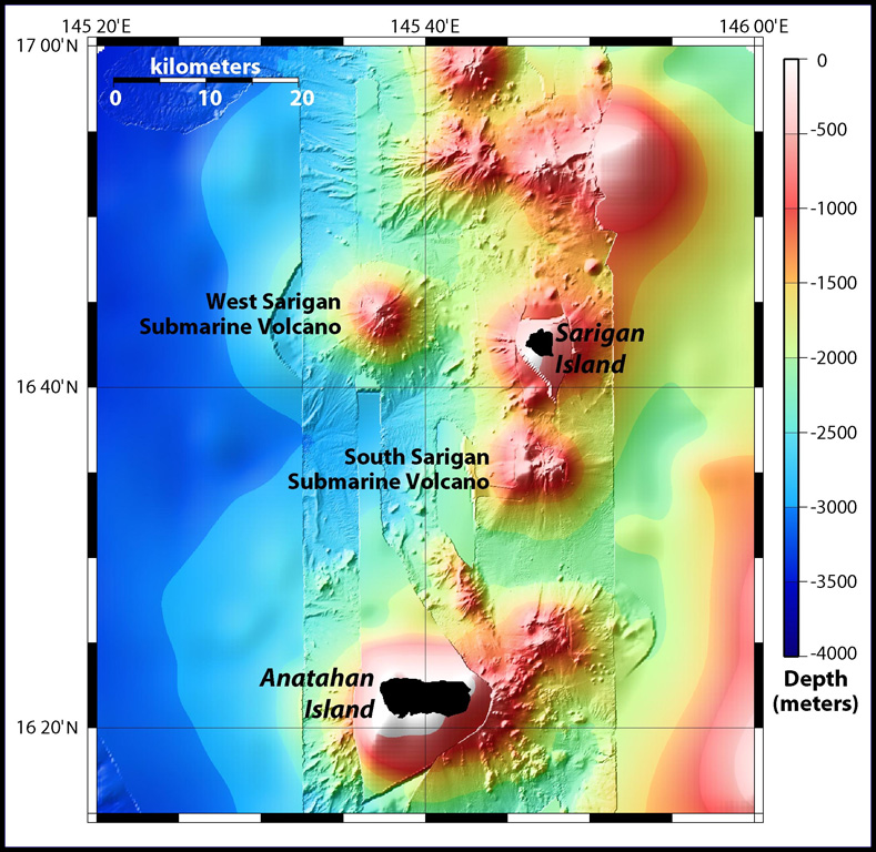
South Sarigan seamount, rising to within about 184 m of the ocean surface 12 km S of Sarigan Island, was the site of a short explosive submarine eruption in May 2010 that produced a plume of ash and steam to 12 km altitude. Sidescan sonar imagery taken in 2003 shows an irregular summit with multiple peaks, including a possibly young cone at about 350 m depth, and flank morphology suggests it is a frequently active volcano.
Riwayat letusan
1 tercatatGlosariumRingkasan (VEI dari waktu ke waktu)
Klik pada bar untuk melihat letusan individu · Gunakan tombol panah untuk berpindah batang, Enter untuk membuka
Garis waktu rinci
- 2010VEI 3Teramati2010-05-27 – 2010-05-29Northern summit cone, 184 m below sea level
Gunung api terdekat
Tautan eksternal
- Belum ada di Wikipedia (Bahasa Indonesia). Anda dapat berkontribusi di Wikidata.
- Halaman asli Smithsonian GVP
⚠ Untuk referensi saja. Bukan untuk tanggap darurat.