Ekuador · Kerucut piroklastik
Licto volcanic field
Licto
- Tipe
- Kerucut piroklastik
- Ketinggian
- 3322 m
- Letusan terakhir
- Tidak diketahui
- Tipe
- Kerucut piroklastik
- Negara
- Ekuador
- Wilayah
- Amerika Selatan / Northern Andean Volcanic Arc
- Ketinggian
- 3322 m
- Koordinat
- -1.786, -78.614
- Letusan terakhir
- Tidak diketahui
- Kondisi tektonik
- Zona subduksi / Kerak benua (> 25 km)
- Bentuk lahan
- Kecil (basaltik)
- Batuan utama
- Andesit / Andesit basaltik
Ringkasan geologi
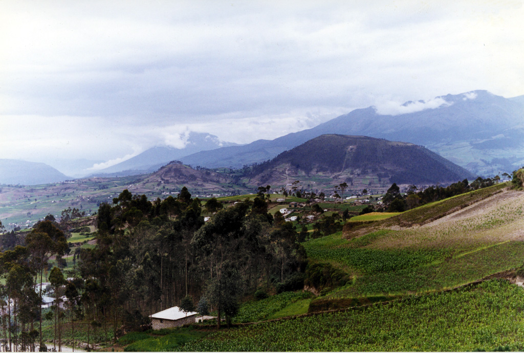
The Licto group of scoria cones lies along the Río Chambo ~25 km SE of the city of Riobamba and just north of the town of Licto. These three basaltic andesite to andesitic cones form the southernmost area of Quaternary volcanism in the Interandean valley of Ecuador. The Cerro Tulabug cone is the largest, with Loma Bellavista ~2 km SE and Licto, the smallest, ~1 km down the WNW flank. The group was considered to be of late Pleistocene or Holocene age (Hall, 1987, pers. comm; Eissen, 2006, pers. comm.) based on the relatively youthful morphology of the cones.
Ringkasan Wikipedia
Ringkasan InggrisRingkasan singkat — buka artikel lengkap untuk detail lebih lanjut.
Licto is a volcanic field in Ecuador, close to the town of Licto.
Wikipedia · CC BY-SA · Baca artikel lengkap →
Riwayat letusan
GlosariumGaris waktu rinci
Tidak ada catatan letusan.
Gunung api terdekat
Tautan eksternal
⚠ Untuk referensi saja. Bukan untuk tanggap darurat.