Cile · Bolivia · Stratovolkan
Irruputuncu
- Tipe
- Stratovolkan
- Ketinggian
- 5163 m
- Letusan terakhir
- 1995
- Tipe
- Stratovolkan
- Negara
- Cile · Bolivia
- Wilayah
- Amerika Selatan / Central Andean Volcanic Arc
- Ketinggian
- 5163 m
- Koordinat
- -20.730, -68.550
- Letusan terakhir
- 1995
- Kondisi tektonik
- Zona subduksi / Kerak benua (> 25 km)
- Bentuk lahan
- Komposit
- Batuan utama
- Andesit / Andesit basaltik
Ringkasan geologi
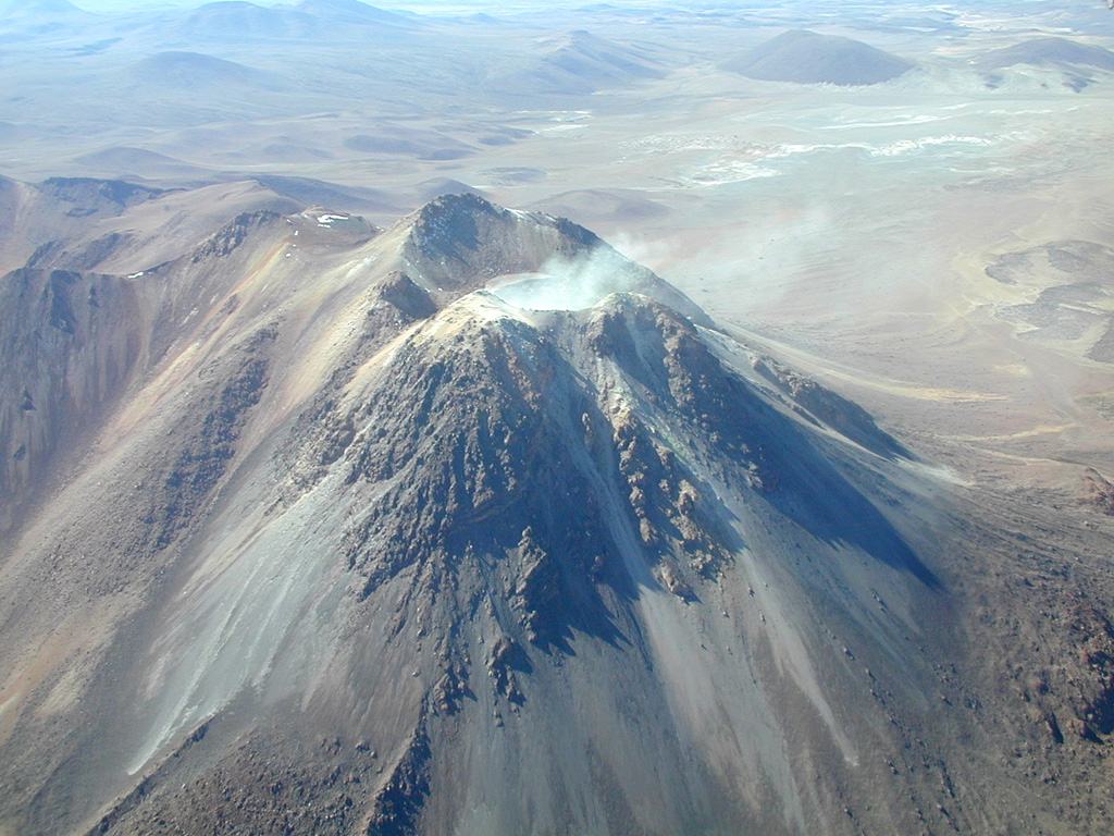
Irruputuncu is a small stratovolcano that straddles the Chile/Bolivia border. It is the youngest and most southerly of a NE-SW-trending chain of volcanoes. It was constructed within the collapse scarp of a Holocene debris avalanche whose deposit extends to the SW. Subsequent eruptions filled much of this scarp and produced thick, viscous lava flows down the W flank. The summit complex contains two craters, the southernmost of which is fumarolically active. The first unambiguous historical eruption took place in November 1995, when phreatic explosions produced dark ash clouds.
Ringkasan Wikipedia
Ringkasan InggrisIrruputuncu is a volcano in the commune of Pica, Tamarugal Province, Tarapacá Region, Chile, as well as San Pedro de Quemes Municipality, Nor Lípez Province, Potosí Department, Bolivia. The mountain's summit is 5,163 m (16,939 ft) high and has two summit craters—the southernmost 200 m (660 ft)-wide one has active fumaroles. The volcano also features lava flows, block and ash flows and several lava domes. The volcano is part of the Andean Central Volcanic Zone (CVZ).
Wikipedia · CC BY-SA · Baca artikel lengkap →
Riwayat letusan
2 tercatatGlosariumGaris waktu rinci
- 1995VEI 2Teramati1995-09-01 – 1995-09-26
- 1989VEI ?Metode tidak dinyatakan1989-12-16 – akhir tidak diketahui
Gunung api terdekat
Tautan eksternal
⚠ Untuk referensi saja. Bukan untuk tanggap darurat.