Argentina · Stratovolkan
Risco Plateado
- Tipe
- Stratovolkan
- Ketinggian
- 4999 m
- Letusan terakhir
- Tidak diketahui
- Tipe
- Stratovolkan
- Negara
- Argentina
- Wilayah
- Amerika Selatan / Southern Andean Volcanic Arc
- Ketinggian
- 4999 m
- Koordinat
- -34.917, -69.981
- Letusan terakhir
- Tidak diketahui
- Kondisi tektonik
- Zona subduksi / Kerak benua (> 25 km)
- Bentuk lahan
- Komposit
- Batuan utama
- Andesit / Andesit basaltik
Ringkasan geologi
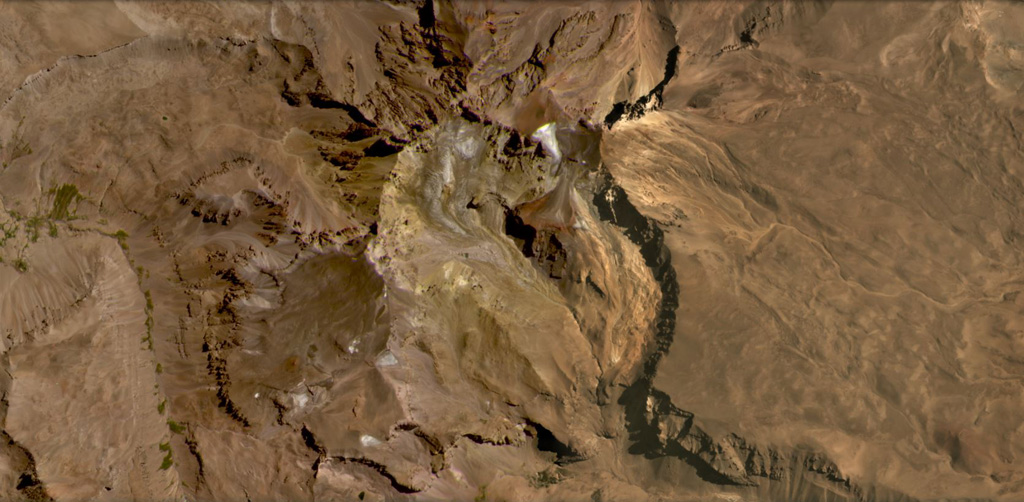
Teks asli bahasa InggrisThe Risco Plateado volcanic complex lies about 10 km S of the Caldera del Atuel and consists of a stratovolcano cut by a 4-km-wide caldera.
Kutipan dari Global Volcanism Program, Smithsonian Institution · Baca ringkasan lengkap di GVP →
Ringkasan Wikipedia
Ringkasan InggrisRisco Plateado is a stratovolcano in Argentina, with an elevation of 4,999 metres (16,401 ft) above sea level.
Wikipedia · CC BY-SA · Lanjutkan membaca di Wikipedia bahasa Inggris →
Riwayat letusan
GlosariumGaris waktu rinci
Tidak ada catatan letusan.
Gunung api terdekat
Tautan eksternal
⚠ Untuk referensi saja. Bukan untuk tanggap darurat.