Etiopia · Frattura eruttiva
Manda Gargori
- Tipo
- Frattura eruttiva
- Altitudine
- 700 m
- Ultima eruzione
- Sconosciuto
- Tipo
- Frattura eruttiva
- Paese
- Etiopia
- Regione
- Africa orientale / Afar Rift Volcanic Province
- Altitudine
- 700 m
- Coordinate
- 11.750, 41.480
- Ultima eruzione
- Sconosciuto
- Contesto tettonico
- Zona di rift / Crosta intermedia (15-25 km)
- Forma vulcanica
- Gruppo vulcanico
- Roccia principale
- Basalto / Picrobasalto
Sintesi geologica
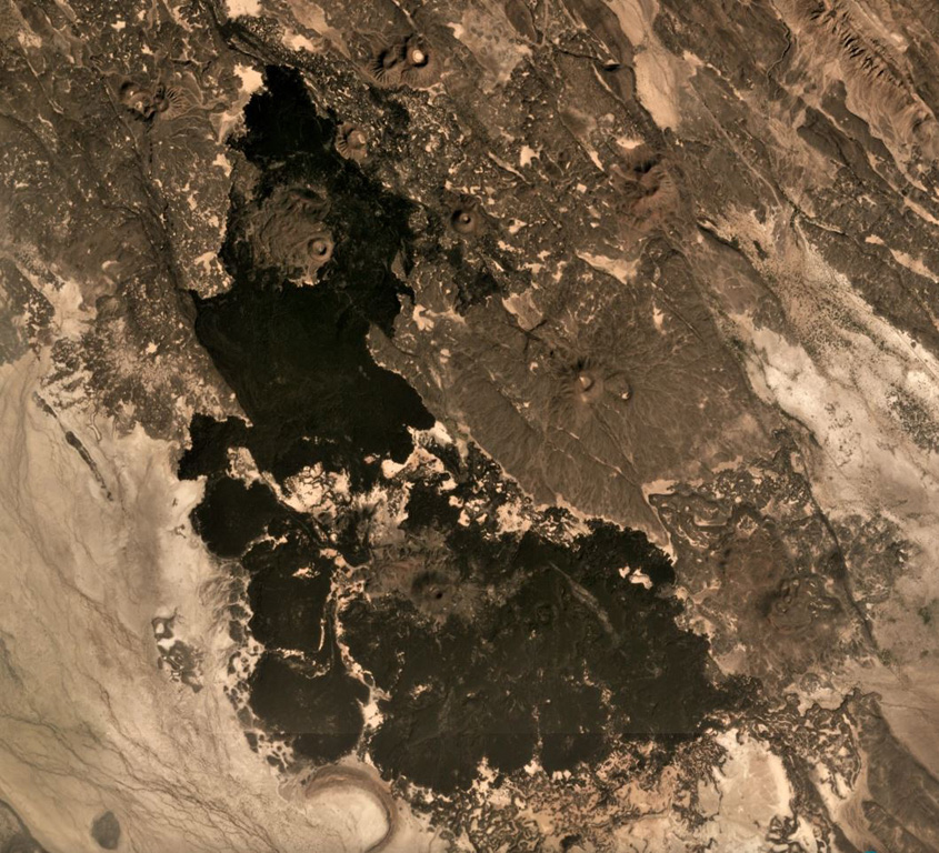
The Manda Gargori rift, located north of the town of Aisa Aita NE of Borawli volcano and SE of Kurub volcano, is the youngest rift segment in the Afar depression and is only one third the width of the adjacent Manda Hararo-Goba'ad rift system to the west. Two older lava flows from the Manda Gargori rift have Pleistocene potassium-argon dates. Youthful-looking lava flows, some of which may have been subaqueous, have been emitted from NNW-trending fissures. A hyaloclastite tuff ring is also present, and a rhyolitic lava dome surrounded by two basaltic lava flows is located north of Uddummi lake. No historical activity has been reported at the dominantly basaltic Manda Gargori rift, but human footprints have been observed in a fresh ashfall deposit, and the eruptive activity is considered to be of historical age.
Storia delle eruzioni
GlossarioCronologia dettagliata
Nessuna registrazione di eruzioni disponibile.
Vulcani nelle vicinanze
Link esterni
- Non ancora su Wikipedia (Italiano). Puoi contribuire su Wikidata.
- Pagina originale Smithsonian GVP
⚠ Solo a scopo informativo. Non adatto a situazioni di emergenza.