Kenya · Vulcano a scudo
Mount Silali
Silali
- Tipo
- Vulcano a scudo
- Altitudine
- 1528 m
- Ultima eruzione
- -5050
- Tipo
- Vulcano a scudo
- Paese
- Kenya
- Regione
- Africa orientale / Kenyan Rift Volcanic Province
- Altitudine
- 1528 m
- Coordinate
- 1.150, 36.230
- Ultima eruzione
- -5050
- Contesto tettonico
- Zona di rift / Crosta continentale (> 25 km)
- Forma vulcanica
- A scudo
- Roccia principale
- Trachite / Trachidacite
Sintesi geologica
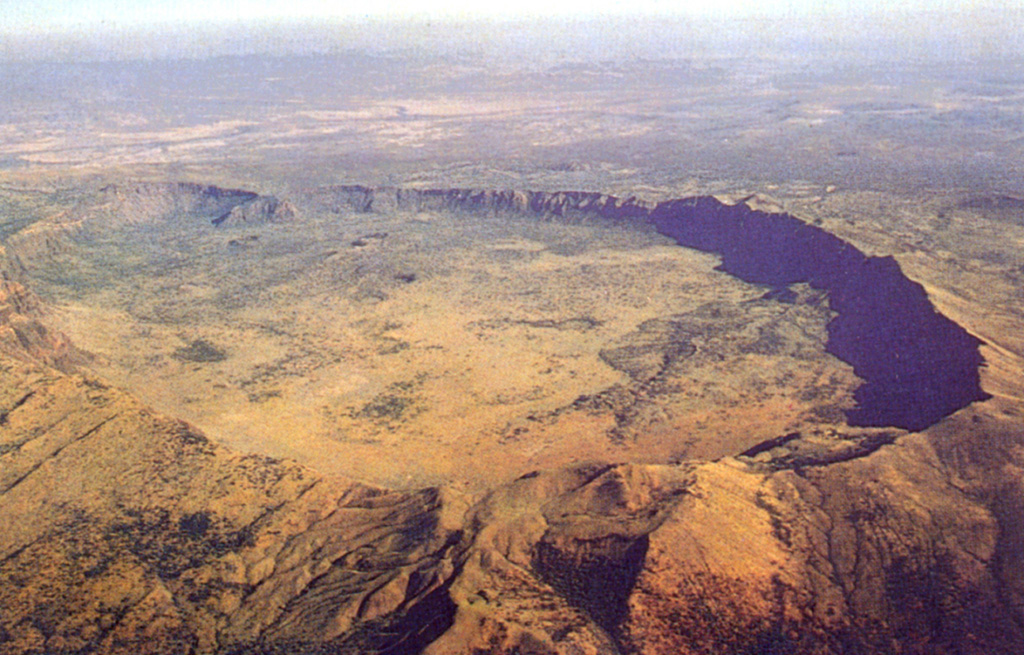
The 30-km-wide Silali trachytic shield volcano, the largest Quaternary volcano in the northern Gregory Rift, completely straddles the East African Rift. The 5 x 8 km summit caldera with 300 m deep walls is thought to have formed incrementally about 63,000 years ago, related to eruption of the Kantenmening basaltic and trachytic lava flows. A series of summit-area lava benches formed by eruptions from circumferential fissures is morphologically similar to Galapagos Islands volcanoes. The N, E, and S flanks are cut by a prominent broad rift zone 10 km wide and 30 km long, with numerous pyroclastic cones. Lava domes on the upper E flank formed during the late Pleistocene and early Holocene, until about 7,000 years ago. Youthful cones are common on the caldera floor and on the N and NE flanks; the youngest lava flows may be little more than a few hundred years old (Williams et al. 1984). Geothermal activity occurs within the caldera and on the upper E flanks.
Storia delle eruzioni
3 registrateGlossarioCronologia dettagliata
- 5050 a.C. (±2000 anni)VEI ?Stima geologica5050 a.C. – fine sconosciutaUpper east flank
- 6050 a.C. (±3000 anni)VEI ?Stima geologica6050 a.C. – fine sconosciutaEastern part of caldera
- 7050 a.C. (±2000 anni)VEI ?Stima geologica7050 a.C. – fine sconosciutaUpper east flank
Vulcani nelle vicinanze
Link esterni
⚠ Solo a scopo informativo. Non adatto a situazioni di emergenza.