Nuova Zelanda · Stratovulcano
Rumble II West Seamount
Rumble II West
- Tipo
- Stratovulcano
- Altitudine
- 1200 m (sottomarino)
- Ultima eruzione
- Sconosciuto
- Tipo
- Stratovulcano
- Paese
- Nuova Zelanda
- Regione
- Tonga e Kermadec / Southern Kermadec Volcanic Arc
- Altitudine
- 1200 m (sottomarino)
- Coordinate
- -35.353, 178.527
- Ultima eruzione
- Sconosciuto
- Contesto tettonico
- Zona di subduzione / Crosta oceanica (< 15 km)
- Forma vulcanica
- Composito
- Roccia principale
- Andesite / Andesite basaltica
Sintesi geologica
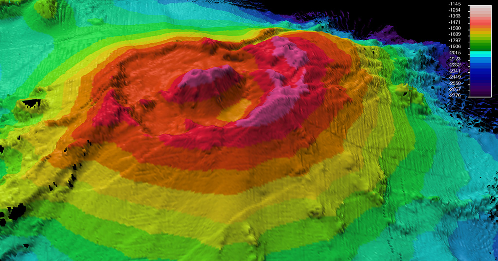
Originale in ingleseRumble II West, about 12 km NW of Rumble II East, rises 1,800 m from the ocean floor to within 1,200 m of the surface.
Estratto dal Global Volcanism Program, Smithsonian Institution · Leggi la sintesi completa sul GVP →
Storia delle eruzioni
GlossarioCronologia dettagliata
Nessuna registrazione di eruzioni disponibile.
Vulcani nelle vicinanze
Link esterni
- Non ancora su Wikipedia (Italiano). Puoi contribuire su Wikidata.
- Pagina originale Smithsonian GVP
⚠ Solo a scopo informativo. Non adatto a situazioni di emergenza.