Papua Nuova Guinea · Stratovulcano
Hargy
- Tipo
- Stratovulcano
- Altitudine
- 1148 m
- Ultima eruzione
- 950
- Tipo
- Stratovulcano
- Paese
- Papua Nuova Guinea
- Regione
- Pacifico sud-occidentale / Bismarck Volcanic Arc
- Altitudine
- 1148 m
- Coordinate
- -5.330, 151.100
- Ultima eruzione
- 950
- Contesto tettonico
- Zona di subduzione / Crosta continentale (> 25 km)
- Forma vulcanica
- Composito
- Roccia principale
- Dacite
Sintesi geologica
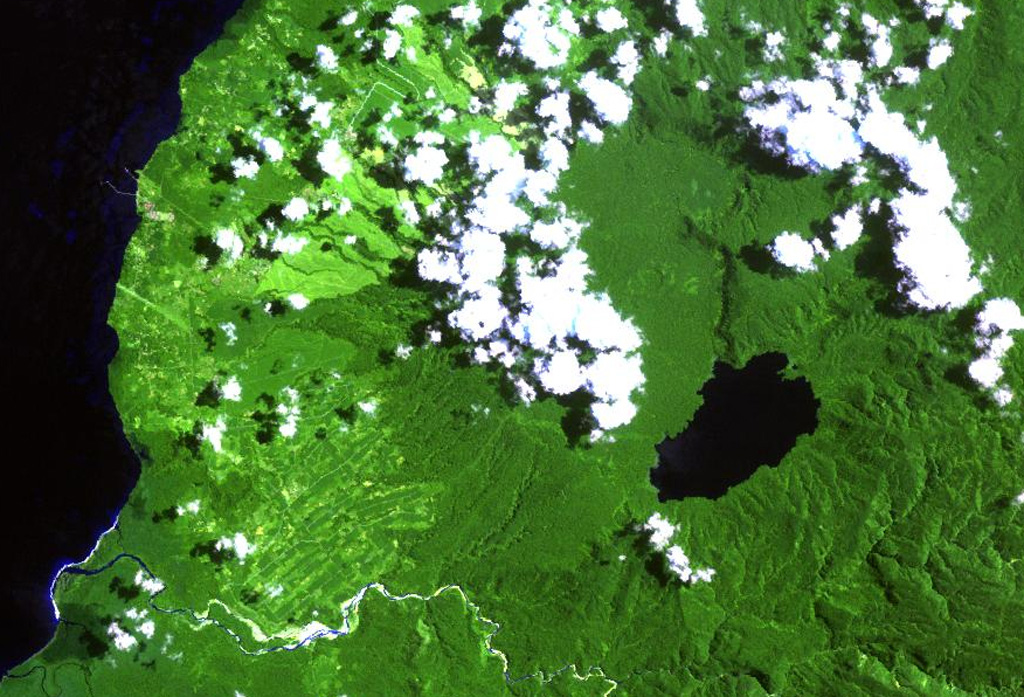
This little-known volcano is one of several major calderas on the island of New Britain. The 10 x 12 km Hargy caldera, whose floor is 150 m above sea level, contains an inner caldera with a steep west-facing wall. A caldera lake on the SE side drains through a narrow gap in the northern caldera wall. The latest caldera-forming eruption of Hargy volcano took place about 11,000 years ago. The dacitic Galloseulo lava cone rises above and partially overtops the western rim of the caldera. A double crater occupies a larger 700-m-wide crater. Numerous small eruptions have taken place at Galloseulo over the past 7000 years, the last occurring about 1000 years ago.
Storia delle eruzioni
2 registrateGlossarioCronologia dettagliata
- 950VEI ?Stima geologica950 – fine sconosciutaGalloseulo
- 5050 a.C.VEI ?Stima geologica5050 a.C. – fine sconosciutaGalloseulo
Vulcani nelle vicinanze
Link esterni
⚠ Solo a scopo informativo. Non adatto a situazioni di emergenza.