Indonesia · Stratovulcano
Gunung Patah
Patah
- Tipo
- Stratovulcano
- Altitudine
- 2836 m
- Ultima eruzione
- Sconosciuto
- Tipo
- Stratovulcano
- Paese
- Indonesia
- Regione
- Sunda e Banda / Sunda Volcanic Arc
- Altitudine
- 2836 m
- Coordinate
- -4.257, 103.306
- Ultima eruzione
- Sconosciuto
- Contesto tettonico
- Zona di subduzione / Crosta continentale (> 25 km)
- Forma vulcanica
- Composito
- Roccia principale
- Nessun dato
Sintesi geologica
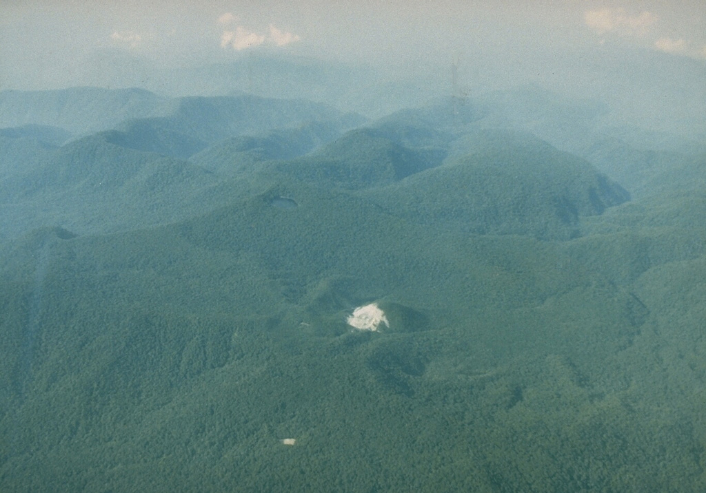
Patah is a heavily forested, dissected Quaternary volcano SE of Dempo volcano. The age of its latest eruptions is not known, although on 1 May 1989 a possible new 150-m-wide crater with active fumaroles was observed by a cargo aircraft pilot in a heavily forested area on the side of a small cone about 3 km SE of Gunung Patah. The exact date of its formation, and its geologic relationship to Patah are uncertain. A crater lake at the summit of another peak, Bukit Belirang (Sulfur Hill), is located 1.5 km S of the fumaroles.
Storia delle eruzioni
GlossarioCronologia dettagliata
Nessuna registrazione di eruzioni disponibile.
Vulcani nelle vicinanze
Link esterni
⚠ Solo a scopo informativo. Non adatto a situazioni di emergenza.