Stati Uniti · Stratovulcano
Seamount X
- Tipo
- Stratovulcano
- Altitudine
- 1230 m (sottomarino)
- Ultima eruzione
- Sconosciuto
- Tipo
- Stratovulcano
- Paese
- Stati Uniti
- Regione
- Pacifico nord-occidentale / Mariana Volcanic Arc
- Altitudine
- 1230 m (sottomarino)
- Coordinate
- 13.250, 144.020
- Ultima eruzione
- Sconosciuto
- Contesto tettonico
- Zona di subduzione / Spessore crostale sconosciuto
- Forma vulcanica
- Composito
- Roccia principale
- Basalto / Picrobasalto
Sintesi geologica
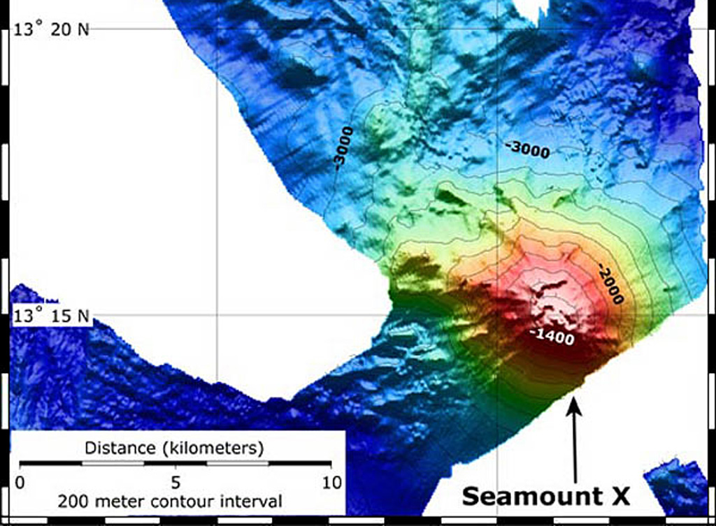
Hydrothermal activity was detected during a 2003 NOAA expedition at a submarine volcano about 70 km WSW of Guam. The summit of the volcano, referred to as Seamount X, lies 1,230 m below the ocean surface. Diffuse sites of thermal venting colonized by shrimps, crabs, and scaleworms were detected near the summit during a 2006 NOAA expedition, and thick deposits of sulfur flows originating from the hydrothermal vent were observed that were covered with thousands of squat lobsters. Basaltic rocks were recovered along with sulfur samples. The summit of the volcano is cut by an elongated caldera.
Storia delle eruzioni
GlossarioCronologia dettagliata
Nessuna registrazione di eruzioni disponibile.
Vulcani nelle vicinanze
Link esterni
- Non ancora su Wikipedia (Italiano). Puoi contribuire su Wikidata.
- Pagina originale Smithsonian GVP
⚠ Solo a scopo informativo. Non adatto a situazioni di emergenza.