Nicaragua · Frattura eruttiva
Nejapa-Miraflores
- Tipo
- Frattura eruttiva
- Altitudine
- 360 m
- Ultima eruzione
- 1060
- Tipo
- Frattura eruttiva
- Paese
- Nicaragua
- Regione
- America Centrale e Caraibi / Central America Volcanic Arc
- Altitudine
- 360 m
- Coordinate
- 12.120, -86.320
- Ultima eruzione
- 1060
- Contesto tettonico
- Zona di subduzione / Crosta continentale (> 25 km)
- Forma vulcanica
- Gruppo vulcanico
- Roccia principale
- Basalto / Picrobasalto
Sintesi geologica
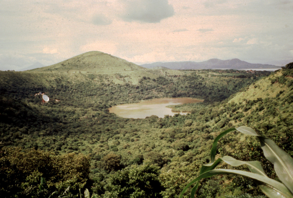
The Nejapa-Miraflores alignment (also known as Nejapa-Ticoma), ~10 km S of Apoyeque near the western margin of the Nicaraguan graben, cuts through the western part of the capital city of Managua and marks the right-lateral offset of the volcanic arc in Nicaragua. This group of features has erupted tholeiitic basaltic rocks similar to those from mid-ocean ridges, with about 40 eruptions during the past 30,000 years, the most recent of which (from Asososca maar) occurred about 1,250 years ago. A series of pit craters and fissure vents extends into Lake Managua and is continuous with the volcanic vents on the Chiltepe peninsula. An area of maars and tuff cones perpendicular to the N-S trend of the alignment forms the scalloped shoreline of Lake Managua. Laguna Tiscapa crater is located several kilometers to the east near the central part of the city of Managua. The elongated Nejapa and Ticoma pit craters are surrounded by small basaltic cinder cones and tuff cones.
Storia delle eruzioni
8 registrateGlossarioCronologia dettagliata
- 1060 (±100 anni)VEI 3Stima geologica1060 – fine sconosciutaNejapa maar
- 550 a.C. (±500 anni)VEI ?Stima geologica550 a.C. – fine sconosciuta
- 3050 a.C. (±500 anni)VEI ?Stima geologica3050 a.C. – fine sconosciuta
- 4390 a.C. (±100 anni)VEI ?Stima geologica4390 a.C. – fine sconosciutaEl Hormigón
- 5230 a.C. (±200 anni)VEI ?Stima geologica5230 a.C. – fine sconosciuta
- 5350 a.C. (±200 anni)VEI ?Stima geologica5350 a.C. – fine sconosciuta
- 7300 a.C. (±3150 anni)VEI ?Stima geologica7300 a.C. – fine sconosciuta
- 7430 a.C. (±300 anni)VEI ?Stima geologica7430 a.C. – fine sconosciutaRefinería crater
Vulcani nelle vicinanze
Link esterni
- Non ancora su Wikipedia (Italiano). Puoi contribuire su Wikidata.
- Pagina originale Smithsonian GVP
⚠ Solo a scopo informativo. Non adatto a situazioni di emergenza.