케냐 · 순상화산
Barrier
Barrier, The
- 화산 유형
- 순상화산
- 해발
- 1032m
- 마지막 분화
- 1921년
- 화산 유형
- 순상화산
- 국가
- 케냐
- 지역
- 동아프리카 / Kenyan Rift Volcanic Province
- 해발
- 1032m
- 좌표
- 2.320, 36.570
- 마지막 분화
- 1921년
- 판구조 환경
- 열곡대 / 대륙 지각 (> 25 km)
- 화산 지형
- 순상화산체
- 주요 암석
- 조면암 / 조면데사이트
지질학적 요약
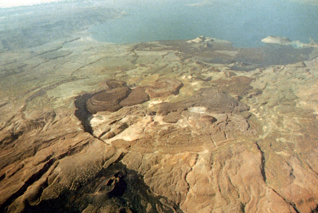
The Barrier volcanic complex separates Lake Turkana from the broad Suguta Trough to the S, the site of a former lake. The volcano is comprised of four overlapping shield volcanoes, with the youngest, Kakorinya, located over the axis of the East African Rift. Kalolenyang volcano lies W of Kakorinya, and Likaiu West and Likaiu East are located to the ENE. A 3.8-km-wide summit caldera was formed at Kakorinya about 92,000 years ago. Youthful-looking trachytic and phonolitic lava domes and flows erupted within the caldera and along its ring fracture fill much of the caldera floor. Early Holocene fissure-related scoria cones and lava flows dot the S and N flanks. Solfataric fields are located within the caldera and on the W and S flanks. Historical eruptions from Teleki's and Andrew's cones on the N and S flanks, respectively, have produced basaltic explosive activity and lava flows during the 19th and 20th centuries.
분화 이력
12건 기록용어집상세 타임라인
- 1921년VEI 2관측 기록1921-12-31 ~ 종료일 미상North flank (Teleki)
- 1920년 (±3년)VEI ?근거 미기재1920-07-02 ~ 종료일 미상South flank (Andrew's Volcano)
- 1917년VEI 2관측 기록1917-07-02 ~ 종료일 미상Andrew's or Teleki's Volcanoes
- 1906년VEI ?근거 미기재1906-07-02 ~ 종료일 미상Andrew's or Teleki's Cones
- 1897년VEI 2관측 기록1897-05-16 ~ 종료일 미상North flank (Teleki) and Likaiu
- 1895년VEI 2관측 기록1895-07-02 ~ 종료일 미상North flank (Teleki's Cone)
- 1888년VEI 0관측 기록1888-07-02 ~ 종료일 미상North flank (Teleki's Cone)
- 1871년 (±3년)VEI 2관측 기록1871-07-02 ~ 종료일 미상North flank (Teleki's Cone)
- 1090년 (±50년)VEI 0지질학적 추정1090 ~ 종료일 미상North flank
- 1050년 (±150년)VEI 0지질학적 추정1050 ~ 종료일 미상North flank
- 1030년 (±150년)VEI 0지질학적 추정1030 ~ 종료일 미상North flank
- 기원전 7710년 (±200년)VEI ?지질학적 추정기원전 7710 ~ 종료일 미상North (Abili Agituk) and south flanks
주변 화산
외부 링크
⚠ 참고용 정보입니다. 재난 대응에 사용하지 마세요.