본문으로 건너뛰기

사우디아라비아 · 화산군

Harrat Kishb

Kishb, Harrat

화산 유형
화산군
해발
1475m
마지막 분화
미확인
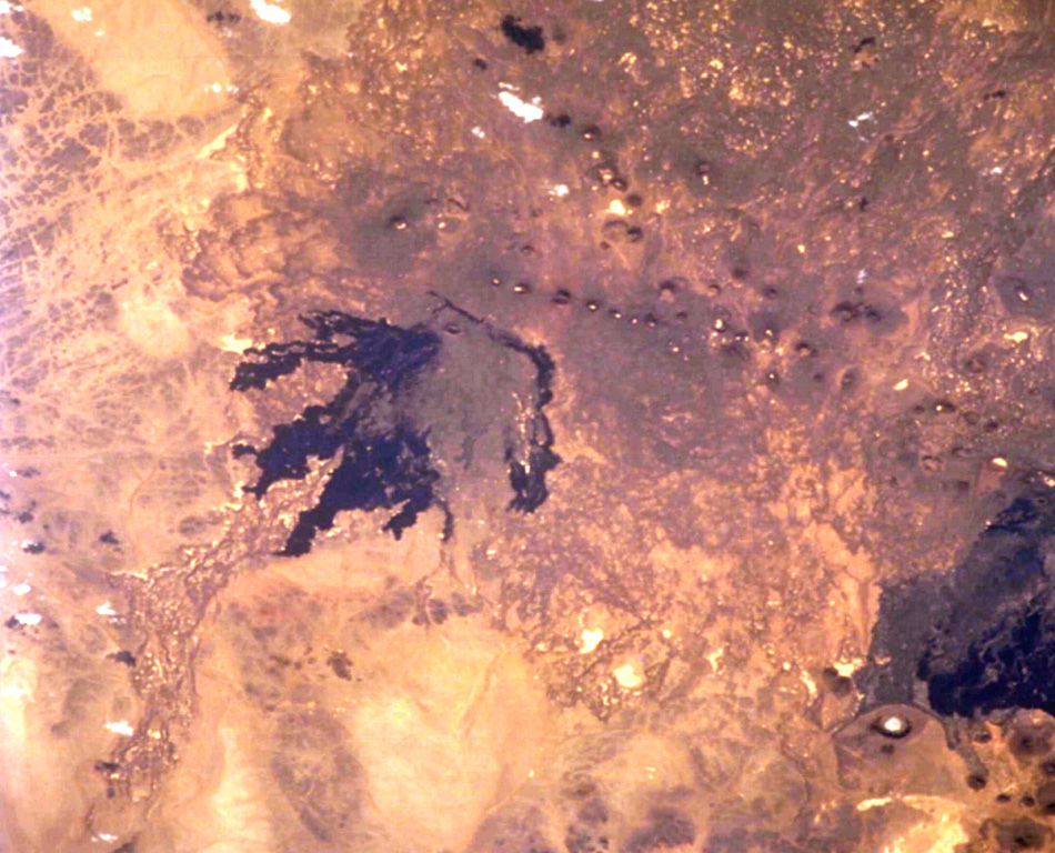
The NW part of the 5,900 km2 Harrat Kishb volcanic field is seen in this Space Shuttle image. The field is located E of a N-S-trending line of volcanic fields in central Saudi Arabia. The medium-brown-colored Jabal Aslaj scoria cone visible near the top of the dark lava flows near the center of the image was the source of the flows seen here. A second area of young flows seen at the lower right surrounds the circular Al Wahbah maar. These lava flows are stratigraphically younger than a 6,500-4,000-year-old pluvial period.
The NW part of the 5,900 km2 Harrat Kishb volcanic field is seen in this Space Shuttle image. The field is located E of a N-S-trending line of volcanic fields in central Saudi Arabia. The medium-brown-colored Jabal Aslaj scoria cone visible near the top of the dark lava flows near the center of the image was the source of the flows seen here. A second area of young flows seen at the lower right surrounds the circular Al Wahbah maar. These lava flows are stratigraphically younger than a 6,500-4,000-year-old pluvial period. · 사진: NASA Space Shuttle image STS102-708-13, 2001 (http://eol.jsc.nasa.gov/).
화산 유형
화산군
국가
사우디아라비아
지역
아라비아·중앙아시아 / Western Arabia Volcanic Province
해발
1475m
좌표
22.800, 41.380
마지막 분화
미확인
판구조 환경
판 내부 / 대륙 지각 (> 25 km)
화산 지형
화산군
주요 암석
조면현무암 / 테프라이트 바사나이트

지질학적 요약

영어 원문

The 5,900 km3 Harrat Kishb volcanic field, located E of a N-S-trending line of volcanic fields in central Saudi Arabia, is comprised of basaltic scoria cones, tuff rings and maars, and phonolitic lava domes and flows.

출처: Global Volcanism Program, Smithsonian Institution (발췌) · GVP에서 전체 요약 읽기 →

Wikipedia 요약

영어 요약

Ḥarrat Kishb is a lava field 5,892 km2 in area, located in western Saudi Arabia.

Wikipedia · CC BY-SA · 영어 위키백과에서 이어 읽기 →

분화 이력

용어집

상세 타임라인

분화 기록이 없습니다.

주변 화산

외부 링크

⚠ 참고용 정보입니다. 재난 대응에 사용하지 마세요.