인도네시아 · 칼데라
Wai Sano
Sano, Wai
- 화산 유형
- 칼데라
- 해발
- 1319m
- 마지막 분화
- 미확인
- 화산 유형
- 칼데라
- 국가
- 인도네시아
- 지역
- 순다·반다 / Sunda Volcanic Arc
- 해발
- 1319m
- 좌표
- -8.735, 120.007
- 마지막 분화
- 미확인
- 판구조 환경
- 섭입대 / 대륙 지각 (> 25 km)
- 화산 지형
- 복성화산체
- 주요 암석
- 데사이트
지질학적 요약
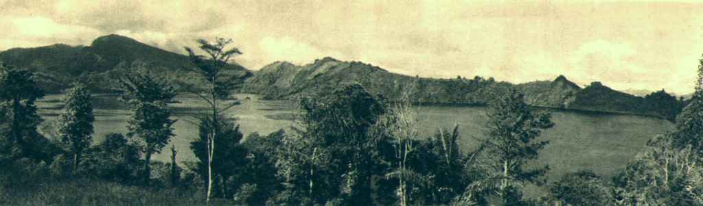
The Wai Sano composite volcano at the western end of Flores Island includes a 2.5 x 3.5 km elliptical caldera in the NW part of a larger 9-10 km edifice. The caldera contains Sanonggoang Lake, with a surface more than 200 m below the high point on the southern caldera rim. The Poco Sesok and Poco Dedeng peaks are near the center of the eroded massif. The area has been a target of geothermal investigations, and two solfataras are located at the SE shore of the lake. No eruptions have been reported or dated, but the area was mapped as Holocene (Ratman and Yasin, 1978).
Wikipedia 요약
영어 요약Wai Sano is a volcano located in the western part of the island of Flores, Indonesia. Wai Sano consists of an elliptical caldera about one mile (2.5 km) wide, containing a lake 260 meters below the 903 meter caldera rim, itself part of Mount Umpu Rua. Two fumaroles are located on the southeastern shore of the lake. No historical eruptions are known.
Wikipedia · CC BY-SA · 전체 기사 보기 →
분화 이력
용어집상세 타임라인
분화 기록이 없습니다.
주변 화산
외부 링크
⚠ 참고용 정보입니다. 재난 대응에 사용하지 마세요.