본문으로 건너뛰기

인도네시아 · 성층화산

Ililabalekan

화산 유형
성층화산
해발
1018m
마지막 분화
미확인
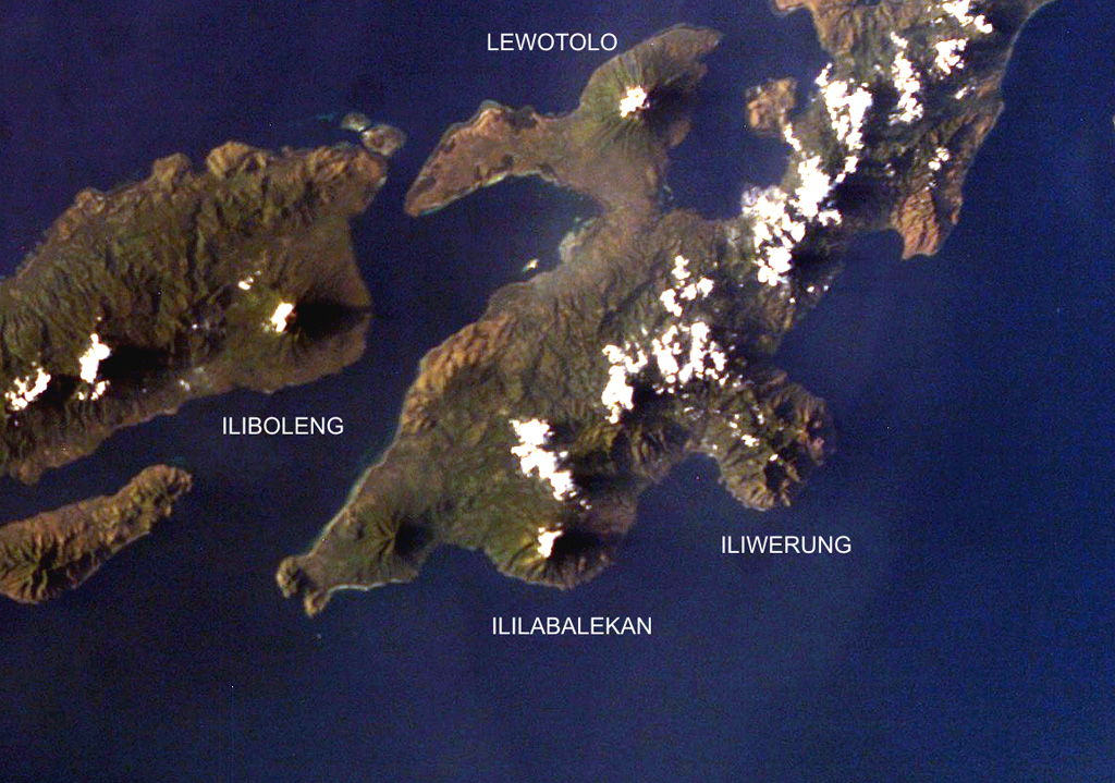
Four volcanoes are seen in this NASA International Space Station image (with north to the upper left) of Solor (lower left), Adonara (upper left), and Lembata (right) Islands.  Ililabalekan volcano on SW Lembata (formerly Lomblen) Island is the only one of these without historical eruptions, although fumaroles are found near its summit.  A satellitic cone was constructed on the SE flank of the steep-sided volcano, and four craters, one of which contains a lava dome and two small explosion pits, occur at the summit of Mount Labalekan.
Four volcanoes are seen in this NASA International Space Station image (with north to the upper left) of Solor (lower left), Adonara (upper left), and Lembata (right) Islands. Ililabalekan volcano on SW Lembata (formerly Lomblen) Island is the only one of these without historical eruptions, although fumaroles are found near its summit. A satellitic cone was constructed on the SE flank of the steep-sided volcano, and four craters, one of which contains a lava dome and two small explosion pits, occur at the summit of Mount Labalekan. · 사진: NASA International Space Station image ISS009-E-7480, 2004 (http://eol.jsc.nasa.gov/).
화산 유형
성층화산
국가
인도네시아
지역
순다·반다 / Sunda Volcanic Arc
해발
1018m
좌표
-8.550, 123.380
마지막 분화
미확인
판구조 환경
섭입대 / 지각 두께 미상
화산 지형
복성화산체
주요 암석
현무암 / 피크로현무암
지질학적 요약

Ililabalekan volcano is situated on a prominent peninsula in SW Lembata (formerly Lomblen) Island. A satellitic cone was constructed on the SE flank of the steep-sided volcano. Four craters, one of which contains a lava dome and two small explosion pits, occur at the summit of Mount Labalekan. No historical eruptions are known from the volcano, although fumaroles are found near its summit.

분화 이력

용어집

상세 타임라인

분화 기록이 없습니다.

주변 화산

외부 링크

⚠ 참고용 정보입니다. 재난 대응에 사용하지 마세요.