본문으로 건너뛰기

인도네시아 · 성층화산

Tobaru

화산 유형
성층화산
해발
1035m
마지막 분화
미확인
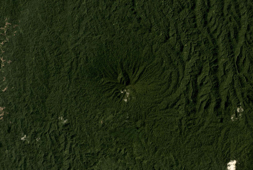
The vegetated Tobaru volcano in western North Maluku, Indonesia, is in the center of this November 2019 Planet Labs satellite image monthly mosaic (N is at the top; this image is approximately 12 km across). There is a possible flank collapse scarp on the western flank.
The vegetated Tobaru volcano in western North Maluku, Indonesia, is in the center of this November 2019 Planet Labs satellite image monthly mosaic (N is at the top; this image is approximately 12 km across). There is a possible flank collapse scarp on the western flank. · 사진: Satellite image courtesy of Planet Labs Inc., 2019 (https://www.planet.com/).
화산 유형
성층화산
국가
인도네시아
지역
서태평양 / Halmahera Volcanic Arc
해발
1035m
좌표
1.630, 127.670
마지막 분화
미확인
판구조 환경
섭입대 / 해양 지각 (< 15 km)
화산 지형
복성화산체
주요 암석
안산암 / 현무암질 안산암
지질학적 요약

Gunung Tobaru, also known as Lolodai, is located in northern Halmahera WSW of Dukono and NNE of Ibu. Supriatna (1980) mapped the little known andesitic volcano as Holocene.

분화 이력

용어집

상세 타임라인

분화 기록이 없습니다.

주변 화산

외부 링크

⚠ 참고용 정보입니다. 재난 대응에 사용하지 마세요.