미국 · 성층화산
Seamount X
- 화산 유형
- 성층화산
- 해발
- 1230m (해저)
- 마지막 분화
- 미확인
- 화산 유형
- 성층화산
- 국가
- 미국
- 지역
- 북서태평양 / Mariana Volcanic Arc
- 해발
- 1230m (해저)
- 좌표
- 13.250, 144.020
- 마지막 분화
- 미확인
- 판구조 환경
- 섭입대 / 지각 두께 미상
- 화산 지형
- 복성화산체
- 주요 암석
- 현무암 / 피크로현무암
지질학적 요약
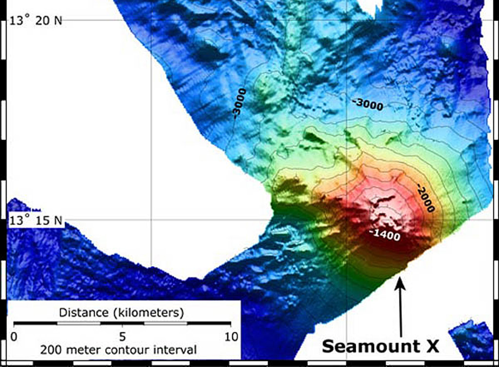
Hydrothermal activity was detected during a 2003 NOAA expedition at a submarine volcano about 70 km WSW of Guam. The summit of the volcano, referred to as Seamount X, lies 1,230 m below the ocean surface. Diffuse sites of thermal venting colonized by shrimps, crabs, and scaleworms were detected near the summit during a 2006 NOAA expedition, and thick deposits of sulfur flows originating from the hydrothermal vent were observed that were covered with thousands of squat lobsters. Basaltic rocks were recovered along with sulfur samples. The summit of the volcano is cut by an elongated caldera.
분화 이력
용어집상세 타임라인
분화 기록이 없습니다.
주변 화산
외부 링크
- 한국어 Wikipedia에 아직 기사가 없습니다. Wikidata에서 작성할 수 있습니다.
- Smithsonian GVP 원본 페이지
⚠ 참고용 정보입니다. 재난 대응에 사용하지 마세요.