일본 (실효지배: 러시아) · 성층화산
Tebenkova
Odamoisan [Tebenkov]
- 화산 유형
- 성층화산
- 해발
- 1208m
- 마지막 분화
- 미확인
- 화산 유형
- 성층화산
- 국가
- 일본 (실효지배: 러시아)
- 지역
- 북서태평양 / Kuril Volcanic Arc
- 해발
- 1208m
- 좌표
- 45.029, 147.917
- 마지막 분화
- 미확인
- 판구조 환경
- 섭입대 / 중간 지각 (15-25 km)
- 화산 지형
- 복성화산체
지질학적 요약
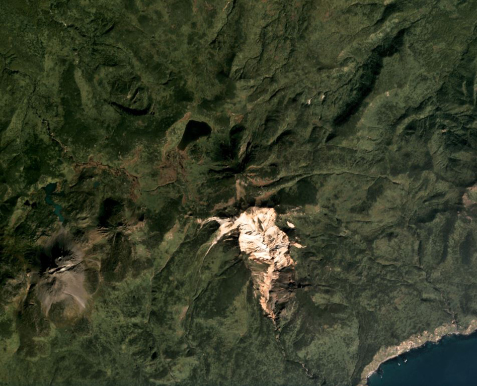
Odamoisan (also known as Tebenkov), lies in the center of Iturup Island along the E coast. This forested andesitic volcano is ~4 km NE of the Etorofu-Yakeyama (Ivan Grozny) dome complex. A large eroded valley on the S side, named the Machekh crater, displays strong fumarolic activity and heavily altered surface deposts. There have been no observed eruptions.
분화 이력
용어집상세 타임라인
분화 기록이 없습니다.
주변 화산
외부 링크
- 한국어 Wikipedia에 아직 기사가 없습니다. Wikidata에서 작성할 수 있습니다.
- Smithsonian GVP 원본 페이지
⚠ 참고용 정보입니다. 재난 대응에 사용하지 마세요.