러시아 · 성층화산
Kolokol Group
- 화산 유형
- 성층화산
- 해발
- 1328m
- 마지막 분화
- 1973년
- 화산 유형
- 성층화산
- 국가
- 러시아
- 지역
- 북서태평양 / Kuril Volcanic Arc
- 해발
- 1328m
- 좌표
- 46.042, 150.083
- 마지막 분화
- 1973년
- 판구조 환경
- 섭입대 / 중간 지각 (15-25 km)
- 화산 지형
- 복성화산체
- 주요 암석
- 안산암 / 현무암질 안산암
지질학적 요약
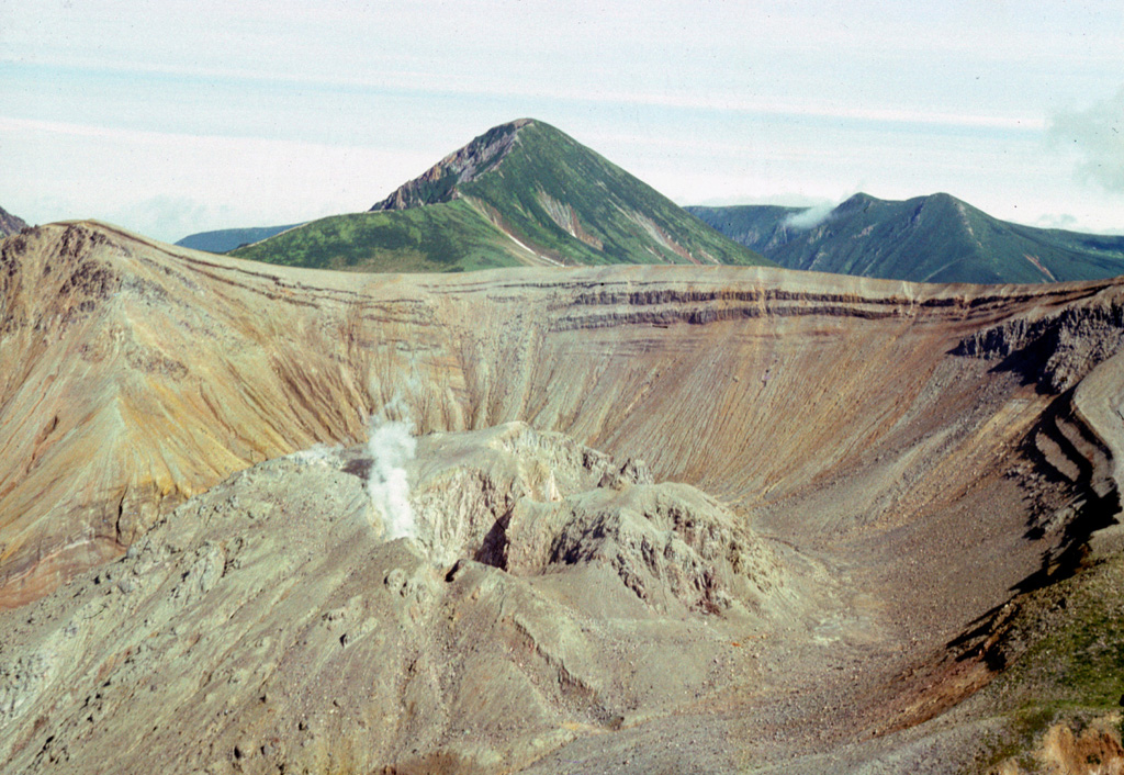
A group of Holocene volcanoes in central Urup Island is named after its most prominent volcano, Kolokol. Berg and Trezubetz volcanoes, flanking Kolokol on the NW, have breached summit calderas partially filled by lava domes. Trezubetz, whose name means "Trident," has an eroded crater rim with three large peaks when seen at sea from the north. Kolokol is sometimes known as Urup-Fuji because of its symmetrical profile. The crater of Kolokol is not well preserved, but there is no evidence of glacial erosion. Several lava flows originate from Kolokol; one of these extends almost to the Sea of Okhotsk coast; a viscous lava flow armoring the SE flank is probably the most recent. Borzov volcano, the oldest of the group, lies to the SW of Kolokol. Eruptions have been observed since the late-18th century. Berg volcano has been most active, but Trezubetz erupted in 1924.
Wikipedia 요약
영어 요약Kolokol Group is a group of somma volcanoes located in the central part of Urup Island, Kuril Islands, Russia. The group is named after its highest volcano but also includes volcanoes called Berg, Trezubetz and Borzov. The most active in the group is Berg, while Borzov is the oldest.
Wikipedia · CC BY-SA · 전체 기사 보기 →
분화 이력
11건 기록용어집상세 타임라인
- 2009년VEI 2근거 미기재2009-08-26 ~ 종료일 미상Berg
- 2005년VEI 1근거 미기재2005-07-02 ~ 종료일 미상Berg
- 1973년VEI 1관측 기록1973-07-25 ~ 1973-07-26Berg (northern part of lava dome)
- 1970년VEI 3관측 기록1970-02-16 ~ 1970-03-16Berg
- 1952년VEI 2관측 기록1952-01-15 ~ 종료일 미상Berg
- 1946년VEI 2관측 기록1946-04-15 ~ 종료일 미상Berg
- 1940년 (±6년)VEI ?관측 기록1940-07-02 ~ 종료일 미상Berg
- 1924년VEI 2관측 기록1924-03-13 ~ 종료일 미상Trezubetz
- 1894년VEI 2관측 기록1894-07-25 ~ 1894-07-26Berg ?
- 1845년VEI 2관측 기록1845-07-02 ~ 1846-07-02Berg
- 1780년 (±10년)VEI 2관측 기록1780 ~ 종료일 미상
주변 화산
외부 링크
⚠ 참고용 정보입니다. 재난 대응에 사용하지 마세요.