본문으로 건너뛰기

미국 · 화산군

St. Michael volcanic field

St. Michael

화산 유형
화산군
해발
715m
마지막 분화
미확인
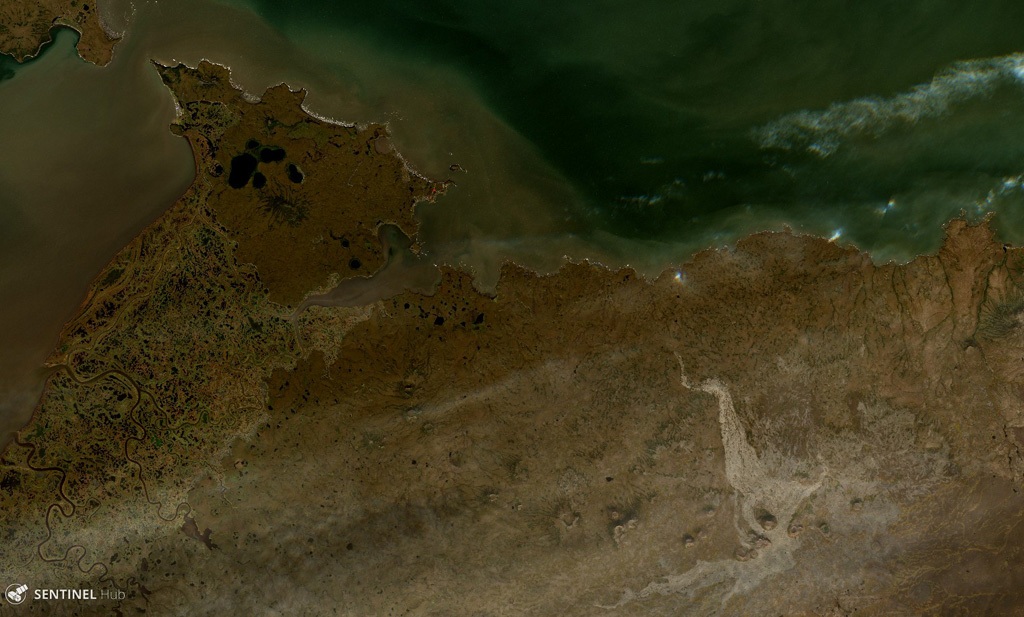
The St. Michael volcanic field consists of more than 55 cones and craters across Stuart Island (upper left) and the peninsula in the center of this  18 August 2020 Sentinel-2 satellite image (N is at the top; this image is approximately 40 km across). The field covers more than 3,000 km2. The Stuart Hill cone is visible in the eastern side of Stuart island, and St. Michael Mountain is in the center of the peninsula area.
The St. Michael volcanic field consists of more than 55 cones and craters across Stuart Island (upper left) and the peninsula in the center of this 18 August 2020 Sentinel-2 satellite image (N is at the top; this image is approximately 40 km across). The field covers more than 3,000 km2. The Stuart Hill cone is visible in the eastern side of Stuart island, and St. Michael Mountain is in the center of the peninsula area. · 사진: Satellite image courtesy of Copernicus Sentinel Data, 2019.
화산 유형
화산군
국가
미국
지역
북아메리카 / Northern Alaska-Bering Sea Volcanic Province
해발
715m
좌표
63.450, -162.120
마지막 분화
미확인
판구조 환경
판 내부 / 대륙 지각 (> 25 km)
화산 지형
화산군
주요 암석
현무암 / 피크로현무암

지질학적 요약

영어 원문

The St. Michael volcanic field, at the south end of Norton Sound, includes more than 55 cones and craters on St. Michael and Stuart islands.

출처: Global Volcanism Program, Smithsonian Institution (발췌) · GVP에서 전체 요약 읽기 →

Wikipedia 요약

영어 요약

The St. Michael volcanic field is a volcanic field located on St. Michael and Stuart Islands in western Alaska, United States.

Wikipedia · CC BY-SA · 영어 위키백과에서 이어 읽기 →

분화 이력

용어집

상세 타임라인

분화 기록이 없습니다.

주변 화산

외부 링크

⚠ 참고용 정보입니다. 재난 대응에 사용하지 마세요.