미국 · 순상화산
Black Butte Crater Lava Field
- 화산 유형
- 순상화산
- 해발
- 1478m
- 마지막 분화
- -8180년
- 화산 유형
- 순상화산
- 국가
- 미국
- 지역
- 북아메리카 / Yellowstone-Snake River Hotspot Volcano Group
- 해발
- 1478m
- 좌표
- 43.185, -114.354
- 마지막 분화
- -8180년
- 판구조 환경
- 열곡대 / 대륙 지각 (> 25 km)
- 화산 지형
- 순상화산체
- 주요 암석
- 현무암 / 피크로현무암
지질학적 요약
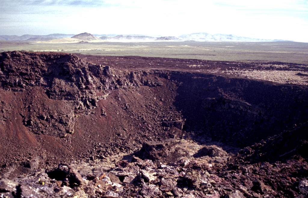
The Black Butte Crater lava field is the westernmost of the young lava fields of the Eastern Snake River Plain. It lies north of Twin Falls, Idaho, and created an L-shaped lava flow 2-5 km wide that extends 60 km S and then west. A single radiocarbon age of 10,130 +/- 350 years BP was obtained for lava flows here (Kuntz et al., 1986). Black Butte Crater caps a lava shield at the NE end of the flow field. The vent area contains a complex lava lake that forms a six-part flower-petal like depression with steep walls up to 30 m high that covers an area of 2 km2. A lava tube and channel system extending 5 km SE of the crater displays both roofed and collapsed portions. The Big Wood and Little Wood rivers follow the northern and southern margins of the distal part of the lava flow, respectively. The voluminous flow diverted the river channels so that they now join 40 km W of their former confluence.
분화 이력
1건 기록용어집상세 타임라인
- 기원전 8180년 (±350년)VEI 0지질학적 추정기원전 8180 ~ 종료일 미상Black Butte Crater
주변 화산
외부 링크
- 한국어 Wikipedia에 아직 기사가 없습니다. Wikidata에서 작성할 수 있습니다.
- Smithsonian GVP 원본 페이지
⚠ 참고용 정보입니다. 재난 대응에 사용하지 마세요.