본문으로 건너뛰기

칠레 · 마르

Cerro Tujle

Tujle, Cerro

화산 유형
마르
해발
3550m
마지막 분화
미확인
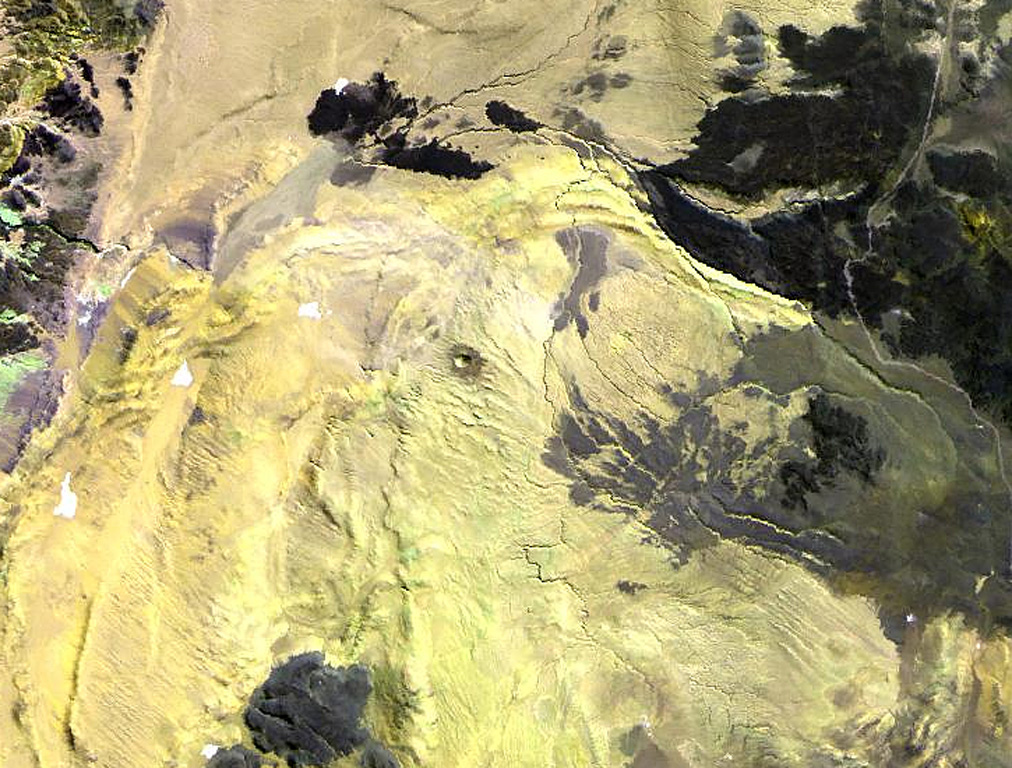
The small dot near the center of this Landsat image is the Cerro Tujle maar (also known as Cerro Tucle or Cerro Tugle).  The Holocene maar has a 60-m-deep crater and is surrounded by a dark-colored ejecta blanket.  The maar is located SE of the Salar de Atacama, north of Cerro Toloncha.
The small dot near the center of this Landsat image is the Cerro Tujle maar (also known as Cerro Tucle or Cerro Tugle). The Holocene maar has a 60-m-deep crater and is surrounded by a dark-colored ejecta blanket. The maar is located SE of the Salar de Atacama, north of Cerro Toloncha. · 사진: NASA Landsat image, 1999 (courtesy of Hawaii Synergy Project, Univ. of Hawaii Institute of Geophysics & Planetology).
화산 유형
마르
국가
칠레
지역
남아메리카 / Central Andean Volcanic Arc
해발
3550m
좌표
-23.830, -67.950
마지막 분화
미확인
판구조 환경
섭입대 / 대륙 지각 (> 25 km)
화산 지형
소규모
주요 암석
자료 없음
지질학적 요약

The Cerro Tujle maar (also known as Cerro Tucle or Cerro Tugle) in the Cordón de Tujle has a 60-m-deep crater (de Silva and Francis, 1991). The maar is located SE of the Salar de Atacama, N of Cerro Toloncha.

분화 이력

용어집

상세 타임라인

분화 기록이 없습니다.

주변 화산

외부 링크

⚠ 참고용 정보입니다. 재난 대응에 사용하지 마세요.