New Zealand · Stratovolcano
Rumble II West Seamount
Rumble II West
- Type
- Stratovolcano
- Elevation
- 1200m (submarine)
- Last eruption
- Unknown
- Type
- Stratovolcano
- Country
- New Zealand
- Region
- Tonga & Kermadec / Southern Kermadec Volcanic Arc
- Elevation
- 1200m (submarine)
- Coordinates
- -35.353, 178.527
- Last eruption
- Unknown
- Tectonic setting
- Subduction zone / Oceanic crust (< 15 km)
- Landform
- Composite
- Major rock type
- Andesite / Basaltic andesite
Geological summary
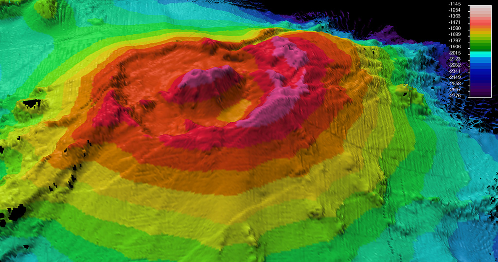
Rumble II West, about 12 km NW of Rumble II East, rises 1,800 m from the ocean floor to within 1,200 m of the surface.
Excerpt from the Global Volcanism Program, Smithsonian Institution · Read the full summary on GVP →
Eruption history
GlossaryDetailed timeline
No eruption records available.
Nearby volcanoes
External links
- Not yet on Wikipedia (English). You can contribute on Wikidata.
- Smithsonian GVP source page
⚠ For reference only. Not for emergency response.