Indonesia · Stratovolcano
Mount Serua
Serua
- Type
- Stratovolcano
- Elevation
- 608m
- Last eruption
- 1921
- Type
- Stratovolcano
- Country
- Indonesia
- Region
- Sunda & Banda / Inner Banda Volcanic Arc
- Elevation
- 608m
- Coordinates
- -6.312, 130.017
- Last eruption
- 1921
- Tectonic setting
- Subduction zone / Oceanic crust (< 15 km)
- Landform
- Composite
- Major rock type
- Andesite / Basaltic andesite
Geological summary
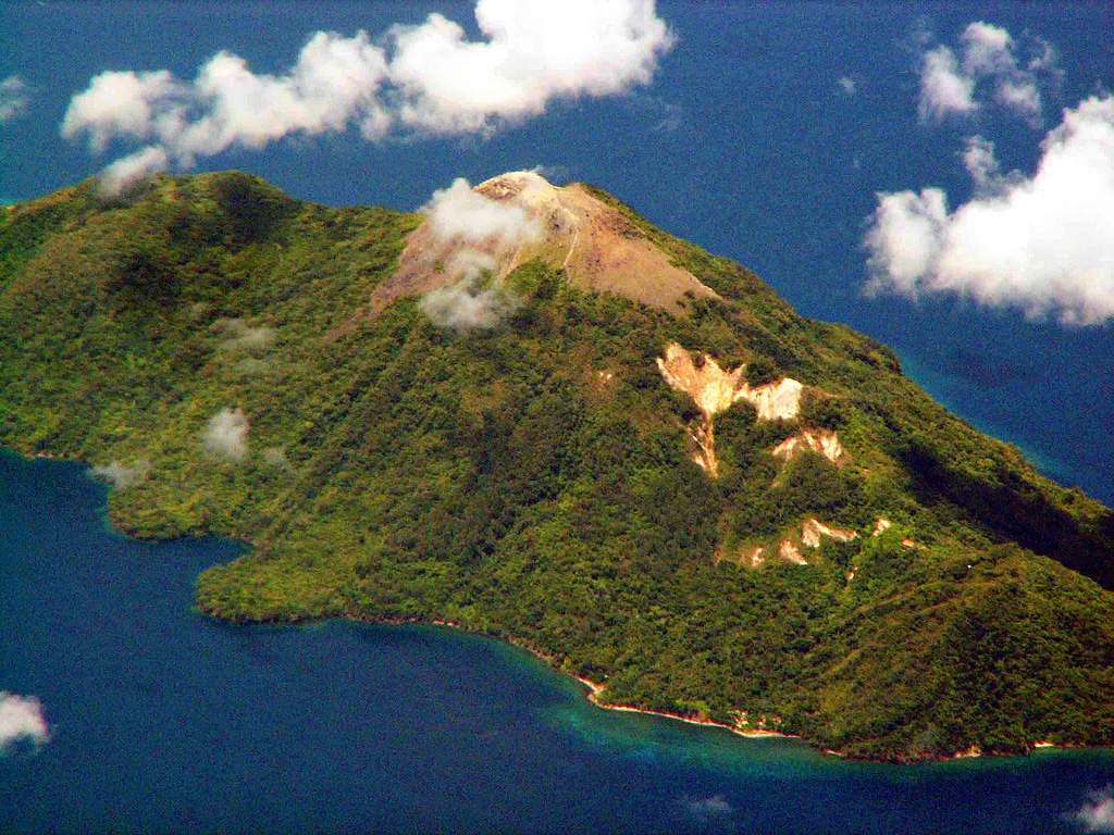
The 2 x 4 km island of Serua is the emergent summit of a volcano rising 3,600 m above the Banda Sea floor. A truncated central cone surrounded by an old crater wall is capped by the Gunung Wuarlapna lava dome. This andesitic volcano, also known as Legatala, lies near the center of the Banda arc and has had many eruptions recorded since the 17th century.
Eruption history
12 recordedGlossarySummary (VEI over time)
Click a bar to see individual eruptions · Use arrow keys to move between bars, Enter to open
Detailed timeline
- 1921VEI 2Observed1921-09-18 – end unknownSummit and south flank
- 1919VEI 2Observed1919-11-16 – end unknown
- 1859VEI 2Observed1859-07-02 – end unknown
- 1858VEI 2Observed1858-07-02 – end unknown
- 1846VEI 2Observed1846-09-16 – end unknown
- 1845VEI 2Method not stated1845-07-02 – end unknown
- 1844VEI 2Observed1844-08-16 – 1844-09-16
- 1694VEI 3Observed1694 – end unknown
- 1693VEI 4Observed1693-06-04 – 1693-07
- 1692VEI ?Method not stated1692-06-04 – end unknown
- 1687VEI 3Observed1687-06-15 – end unknown
- 1683VEI 3Observed1683 – end unknown
Nearby volcanoes
External links
⚠ For reference only. Not for emergency response.