United States · Volcanic field
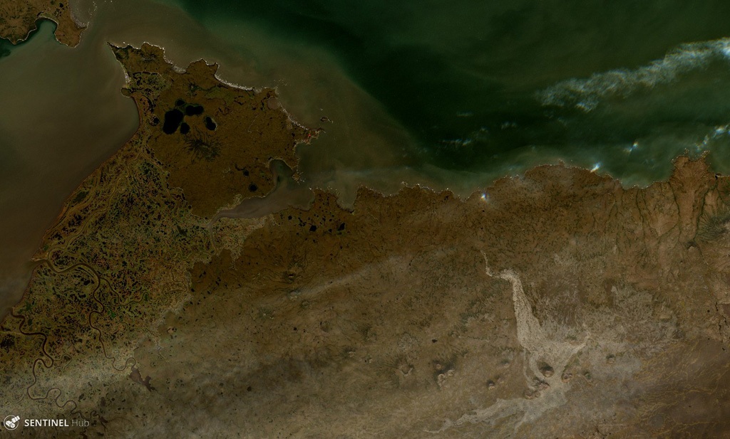
St. Michael volcanic field
St. Michael
- Type
- Volcanic field
- Elevation
- 715m
- Last eruption
- Unknown
- Type
- Volcanic field
- Country
- United States
- Region
- North America / Northern Alaska-Bering Sea Volcanic Province
- Elevation
- 715m
- Coordinates
- 63.450, -162.120
- Last eruption
- Unknown
- Tectonic setting
- Intraplate / Continental crust (> 25 km)
- Landform
- Cluster
- Major rock type
- Basalt / Picro-basalt
Geological summary
The St. Michael volcanic field, at the south end of Norton Sound, includes more than 55 cones and craters on St. Michael and Stuart islands.
Excerpt from the Global Volcanism Program, Smithsonian Institution · Read the full summary on GVP →
From Wikipedia
The St. Michael volcanic field is a volcanic field located on St. Michael and Stuart Islands in western Alaska, United States. It contains 55 cones and craters, including low broad shield volcanoes and maars. It is considered part of the Bering Sea Volcanic Province.
Wikipedia · CC BY-SA · Read full article →
Eruption history
GlossaryDetailed timeline
No eruption records available.
Nearby volcanoes
External links
⚠ For reference only. Not for emergency response.