Antarctica · Stratovolcano
Melville Peak
Melville
- Type
- Stratovolcano
- Elevation
- 549m
- Last eruption
- Unknown
- Type
- Stratovolcano
- Country
- Antarctica
- Region
- Antarctic & Scotia / South Shetlands Volcanic Arc
- Elevation
- 549m
- Coordinates
- -62.020, -57.670
- Last eruption
- Unknown
- Tectonic setting
- Intraplate / Continental crust (> 25 km)
- Landform
- Composite
Geological summary
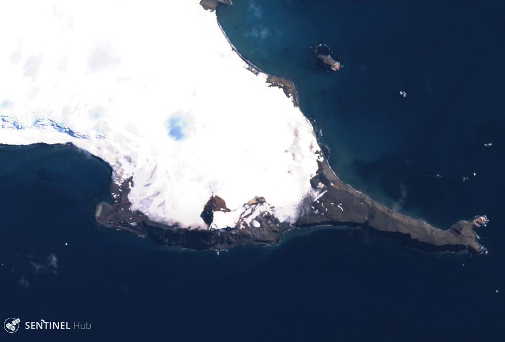
Melville Peak is an eroded stratovolcano on NE King George Island with a summit crater.
Excerpt from the Global Volcanism Program, Smithsonian Institution · Read the full summary on GVP →
From Wikipedia
Melville Peak is a prominent peak surmounting Cape Melville, the eastern cape of King George Island, in the South Shetland Islands off Antarctica. It represents an eroded stratovolcano of unknown age and contains a volcanic crater at its summit. A volcanic ash layer similar in composition to Melville Peak has been identified 30 km (19 mi) away from the volcano and may indicate Melville Peak has been volcanically active in the last few thousand years.
Wikipedia · CC BY-SA · Read full article →
Eruption history
GlossaryDetailed timeline
No eruption records available.
Nearby volcanoes
External links
⚠ For reference only. Not for emergency response.