Etiopía · Fisura volcánica
East Zway
East Ziway
- Tipo
- Fisura volcánica
- Altitud
- 1889 m
- Última erupción
- Desconocido
- Tipo
- Fisura volcánica
- País
- Etiopía
- Región
- África Oriental / Main Ethiopian Rift Volcanic Province
- Altitud
- 1889 m
- Coordenadas
- 7.874, 38.902
- Última erupción
- Desconocido
- Contexto tectónico
- Zona de rift / Corteza continental (> 25 km)
- Forma volcánica
- Grupo volcánico
- Roca principal
- Basalto / Picrobasalto
Resumen geológico
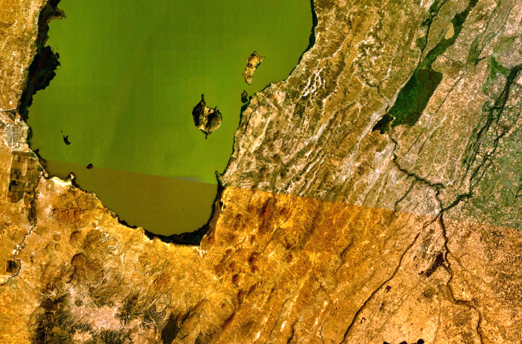
A large area of basaltic cinder cones and lava flows lies within about 5 km of the SE shore of Lake Ziway, and also forms islands along its E shore. About 80 vents were formed along the East Ziway segment of the Wonji Fault Belt. The youngest lava flows have been unaffected by the latest tectonic faulting along the Ethiopian Rift.
Historial de erupciones
GlosarioLínea de tiempo detallada
No hay registros de erupciones disponibles.
Volcanes cercanos
Enlaces externos
- Todavía no está en Wikipedia (Español). Puede contribuir en Wikidata.
- Página original del Smithsonian GVP
⚠ Solo como referencia. No apto para respuesta ante emergencias.