Yemen · Campo volcánico
Haylan, Jabal
- Tipo
- Campo volcánico
- Altitud
- 1550 m
- Última erupción
- -1200
- Tipo
- Campo volcánico
- País
- Yemen
- Región
- Arabia y Asia Central / Southwest Arabia Volcanic Province
- Altitud
- 1550 m
- Coordenadas
- 15.400, 45.100
- Última erupción
- -1200
- Contexto tectónico
- Intraplaca / Corteza continental (> 25 km)
- Forma volcánica
- Grupo volcánico
- Roca principal
- Basalto / Picrobasalto
Resumen geológico
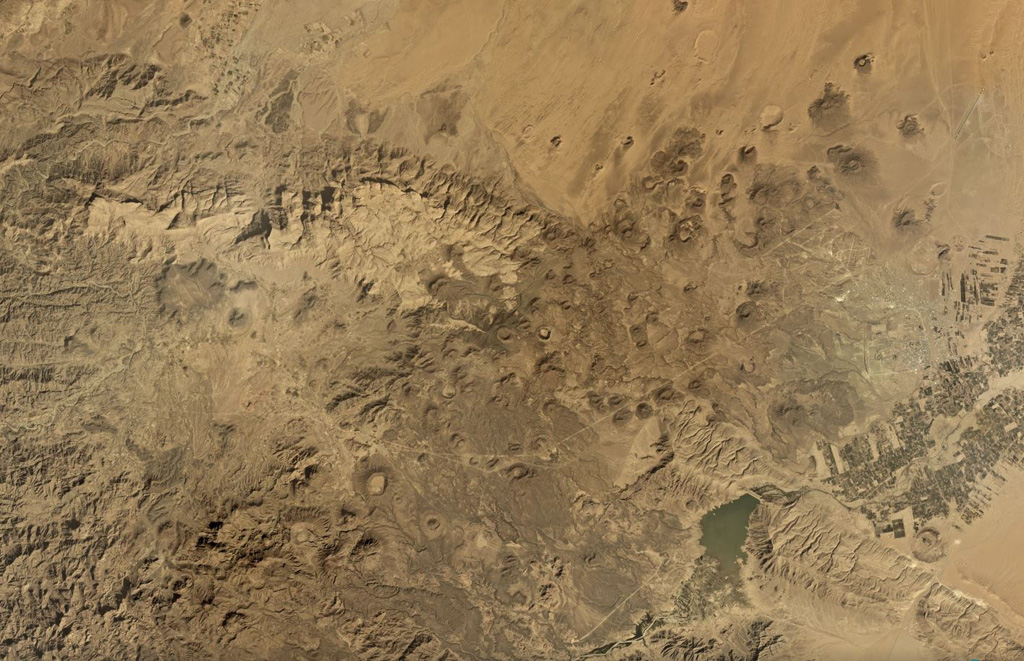
The Jabal Haylan area contains a 75-km-long chain of tuff cones and associated olivine basaltic lava flows in eastern Yemen. The chain crosses a NW-SE-trending fault extending between the highlands and desert lowlands to the east. One of the lava flows covers alluvial terraces that accumulated behind man-made dams from about 800-1200 BCE (Catalog of Active Volcanoes of the World).
Historial de erupciones
1 registradasGlosarioResumen (VEI en el tiempo)
Haga clic en una barra para ver erupciones individuales · Usa las flechas para moverte entre barras y Enter para abrir
Línea de tiempo detallada
- 1200 a. C.VEI 0Estimación geológica1200 a. C. – fin desconocidoWest of Sirwan
Volcanes cercanos
Enlaces externos
- Todavía no está en Wikipedia (Español). Puede contribuir en Wikidata.
- Página original del Smithsonian GVP
⚠ Solo como referencia. No apto para respuesta ante emergencias.