Canadá · Fisura volcánica
Endeavour Segment
- Tipo
- Fisura volcánica
- Altitud
- 2050 m (submarino)
- Última erupción
- -3490
- Tipo
- Fisura volcánica
- País
- Canadá
- Región
- Pacífico Oriental / Northeast Pacific Rifts Volcanic Province
- Altitud
- 2050 m (submarino)
- Coordenadas
- 47.950, -129.100
- Última erupción
- -3490
- Contexto tectónico
- Zona de rift / Corteza oceánica (< 15 km)
- Forma volcánica
- Grupo volcánico
- Roca principal
- Basalto / Picrobasalto
Resumen geológico
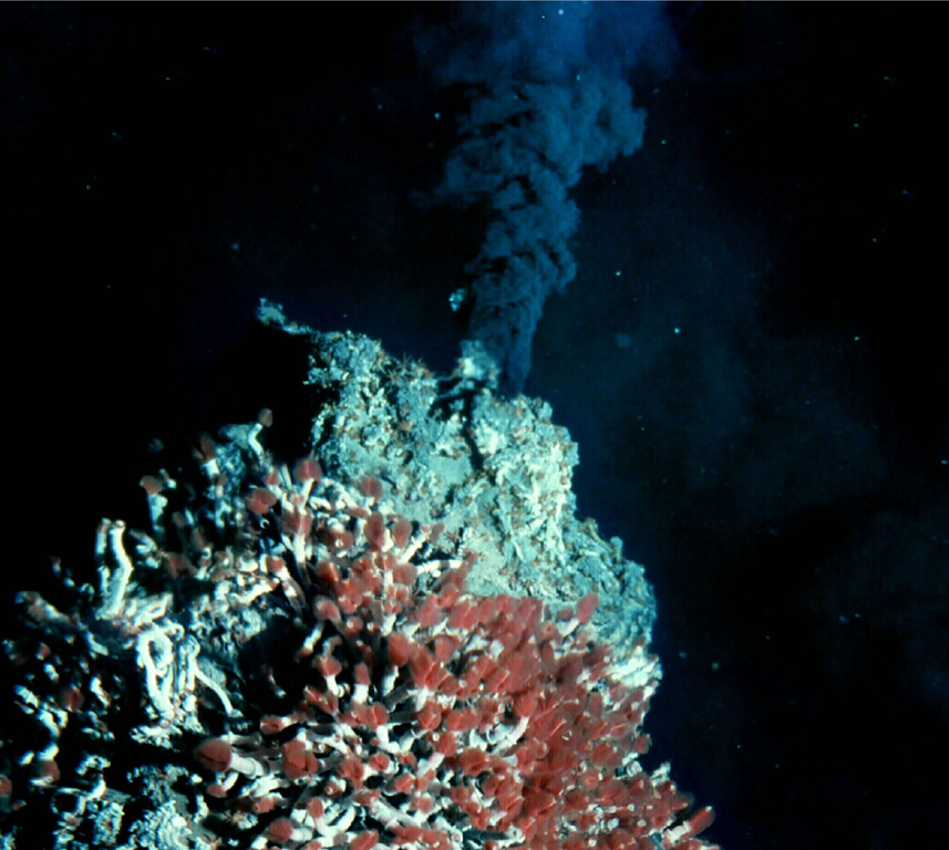
The Endeavour Segment (or Ridge) lies near the northern end of the Juan de Fuca Ridge, W of the coast of Washington and SW of Vancouver Island. The northern end is offset to the east with respect to the West Valley Segment, which extends north to the triple junction with the Sovanco Fracture Zone and the Nootka Fault. The 90-km-long, NNE-SSW-trending segment lies at a depth of more than 2,000 m and is the site of vigorous high-temperature hydrothermal vent systems that were discovered in 1981. Five major vent fields that include sulfide chimneys and black smoker vents are spaced at about 2-km intervals in a 1-km-wide axial valley at the center of the ridge. Preliminary uranium-series dates of Holocene age were obtained on basaltic lava flows, and other younger "zero-age" flows were sampled. Seismic swarms were detected in 1991 and 2005.
Historial de erupciones
2 registradasGlosarioLínea de tiempo detallada
- 3490 a. C.VEI 0Estimación geológica3490 a. C. – fin desconocido
- 6930 a. C.VEI 0Estimación geológica6930 a. C. – fin desconocido
Volcanes cercanos
Enlaces externos
- Todavía no está en Wikipedia (Español). Puede contribuir en Wikidata.
- Página original del Smithsonian GVP
⚠ Solo como referencia. No apto para respuesta ante emergencias.