Estados Unidos · Fisura volcánica
Escanaba Segment
- Tipo
- Fisura volcánica
- Altitud
- 1700 m (submarino)
- Última erupción
- -2260
- Tipo
- Fisura volcánica
- País
- Estados Unidos
- Región
- Pacífico Oriental / Northeast Pacific Rifts Volcanic Province
- Altitud
- 1700 m (submarino)
- Coordenadas
- 40.980, -127.500
- Última erupción
- -2260
- Contexto tectónico
- Zona de rift / Corteza oceánica (< 15 km)
- Forma volcánica
- Grupo volcánico
- Roca principal
- Basalto / Picrobasalto
Resumen geológico
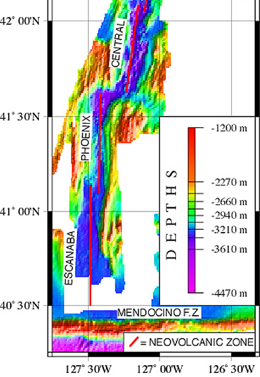
The linear, N-S-trending Escanaba Segment, the southernmost of the Gorda Ridge, lies immediately north of the Mendocino Fracture Zone off the coast of northern California. The axial crest of the 130-km-long segment, also known as the Escanaba Trough, is about 3-5 km wide at the northern end and increases to 18 km to the south near the junction with the Mendocino FZ. The rift valley floor of the slow-spreading segment lies at about 3,200 m depth, bounded by faulted walls about 1,500 m high with unusual gold-bearing massive sulfide deposits in sediment hills at the base of the scarps uplifted by volcanic sills or laccoliths. Thick sediment deposits from the continental margin enter the axial trough from the fracture zone and thin to the north. A preliminary uranium-series date of Holocene age was obtained from a basaltic lava flow in the axial valley in the less-sedimented northern part.
Historial de erupciones
1 registradasGlosarioLínea de tiempo detallada
- 2260 a. C.VEI 0Estimación geológica2260 a. C. – fin desconocido40 deg 59 min North
Volcanes cercanos
Enlaces externos
- Todavía no está en Wikipedia (Español). Puede contribuir en Wikidata.
- Página original del Smithsonian GVP
⚠ Solo como referencia. No apto para respuesta ante emergencias.