Formas submarinas · Fisura volcánica
Southern EPR-Segment K
Southern EPR at 17.5°S (Segment K)
- Tipo
- Fisura volcánica
- Altitud
- 2566 m (submarino)
- Última erupción
- 1990
- Tipo
- Fisura volcánica
- País
- Formas submarinas
- Región
- Pacífico Sur / Southern East Pacific Rise Volcanic Province
- Altitud
- 2566 m (submarino)
- Coordenadas
- -17.436, -113.206
- Última erupción
- 1990
- Contexto tectónico
- Zona de rift / Corteza oceánica (< 15 km)
- Forma volcánica
- Grupo volcánico
- Roca principal
- Basalto / Picrobasalto
Resumen geológico
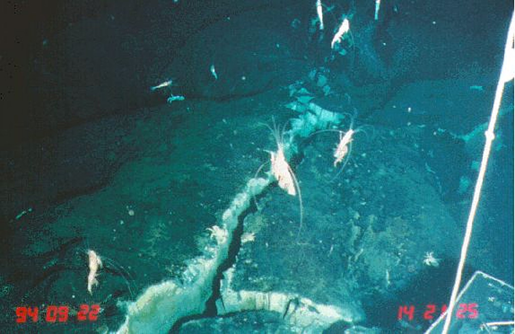
Original en inglésLava flows from a very recent eruption were observed in 1994 along segment K of the southern East Pacific Rise.
Extracto del Global Volcanism Program, Smithsonian Institution · Leer el resumen completo en el GVP →
Historial de erupciones
5 registradasGlosarioResumen del registro
- Erupciones confirmadas
- 5
- Erupciones inciertas
- 0
- Período del registro confirmado
- 1625 – 1990
- Mayor erupción confirmada
- VEI 0 (1990, la más reciente de 5)
- Erupciones confirmadas desde 1900
- 3
Resumen (VEI en el tiempo)
Haga clic en una barra para ver erupciones individuales · Usa las flechas para moverte entre barras y Enter para abrir
Línea de tiempo detallada
- 1990 (±2 años)VEI 0Observado1990-07-02 – fin desconocido
- 1965VEI 0Estimación geológica1965-07-02 – fin desconocidoSouth of Aldo-Kihi lava flow
- 1930VEI 0Estimación geológica1930-07-02 – fin desconocidoNorth of Aldo-Kiri lava flow
- 1840VEI 0Estimación geológica1840-07-02 – fin desconocidoNorth of Aldo-Kiri lava flow
- 1625VEI 0Estimación geológica1625 – fin desconocidoSouth of Aldo-Kihi lava flow
Volcanes cercanos
- Southern EPR-Segment JFisura volcánica · a 84 km
- Southern EPR-Segment IFisura volcánica · a 124 km
- Isla de PascuaVolcán en escudo · a 1146 km
- Volcán submarino de la Dorsal del Pacífico Oriental a 8° SurFisura volcánica · a 1167 km
- Adams SeamountDomo de lava · a 1880 km
- Cerro AzulVolcán en escudo · a 3009 km
Enlaces externos
- Todavía no está en Wikipedia (Español). Puede contribuir en Wikidata.
- Página original del Smithsonian GVP
⚠ Solo como referencia. No apto para respuesta ante emergencias.