Yaman · Medan gunung api
Harra of Arhab
Arhab, Harra of
- Tipe
- Medan gunung api
- Ketinggian
- 3100 m
- Letusan terakhir
- 500
- Tipe
- Medan gunung api
- Negara
- Yaman
- Wilayah
- Arab & Asia Tengah / Southwest Arabia Volcanic Province
- Ketinggian
- 3100 m
- Koordinat
- 15.602, 44.098
- Letusan terakhir
- 500
- Kondisi tektonik
- Intralempeng / Kerak benua (> 25 km)
- Bentuk lahan
- Gugusan gunung api
- Batuan utama
- Trakibasal / Tefrit basanit
Ringkasan geologi
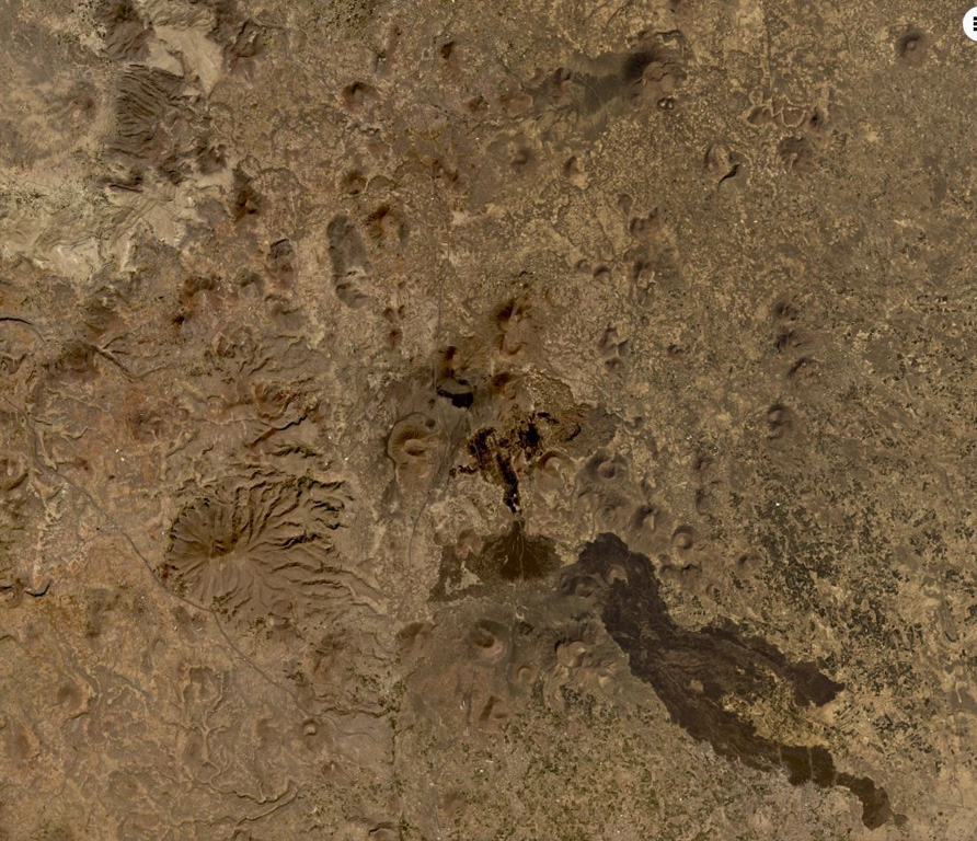
The Quaternary Harra of Arhab in Yemen, north of the capital city of Sana'a, consists of a 1,500 km2 basaltic plateau capped by a few small stratovolcanoes and about 60 scoria cones, two of which have erupted in historical time. Cones in the volcanic field (also known as the Sana'a or the Sana'a-Amran volcanic field) are commonly aligned along a NNW trend above a 100-250-m-thick volcanic plateau. Pliocene-to-Holocene volcanic rocks have a dominantly basaltic-to-hawaiitic composition and overlie the northern end of an area of extensive Oligocene-Miocene basaltic-to-rhyolitic rocks that extends to the SW tip of the Arabian Peninsula. Baker et al. (1997) include outcrops of Quaternary volcanism south of the main area of lava flows, such as Jabal al Marha, as part of this system, but note that they can be difficult to distinguish from Oligocene flood basalts. The latest eruption took place between about 400 and 600 CE and produced a lava flow that traveled 9 km.
Ringkasan Wikipedia
Ringkasan InggrisThe mainly Quaternary Harra of Arhab is the northernmost, historically active volcanic field in Yemen. Also known as the "Sana'a-'Amran volcanic field", or simply the "Sana'a volcanic field", it has erupted in ancient times.
Wikipedia · CC BY-SA · Baca artikel lengkap →
Riwayat letusan
2 tercatatGlosariumGaris waktu rinci
- 500 (±100 tahun)VEI 0Teramati500 – akhir tidak diketahuiSouth flank of Kaulet Hattab
- 200VEI 2Perkiraan geologi200 – akhir tidak diketahuiEast flank of Jabal Zebib
Gunung api terdekat
Tautan eksternal
⚠ Untuk referensi saja. Bukan untuk tanggap darurat.