Rusia · Kerucut piroklastik
Zavaritsky
- Tipe
- Kerucut piroklastik
- Ketinggian
- 1547 m
- Letusan terakhir
- -800
- Tipe
- Kerucut piroklastik
- Negara
- Rusia
- Wilayah
- Pasifik Barat Laut / Eastern Kamchatka Volcanic Arc
- Ketinggian
- 1547 m
- Koordinat
- 53.907, 158.385
- Letusan terakhir
- -800
- Kondisi tektonik
- Zona subduksi / Kerak benua (> 25 km)
- Bentuk lahan
- Komposit
- Batuan utama
- Basal / Pikrobasal
Ringkasan geologi
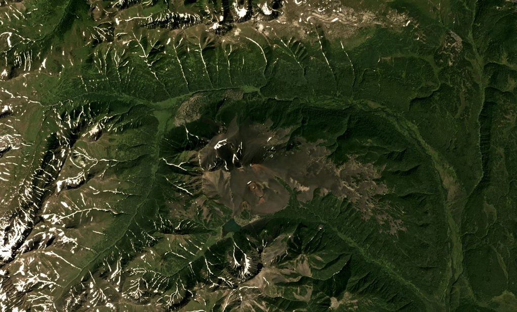
Zavaritsky volcano consists of a complex of six cinder cones trending NW-SE, and an explosion crater located near the headwaters of the Levaya Avacha River west of the main Eastern Kamchatka volcanic arc. The six cones were formed during an eruption about 2,800 years ago, during which associated lava flows blocked the Levaya Avacha and Ozernaya rivers, forming Lake Vulkanischeskoe along the Ozernaya drainage. The highest cone, Mount Peschanaya, lies near the southern end of the cone group. Other monogenetic cinder cones are located NW and NE of the volcano. The Berezovy cinder cone to the NW erupted ~11,000-10,000 radiocarbon years ago. An unnamed cone near the crest of a range dividing the Srednaya Avacha and Kavicha river drainages, about 14 km WNW, erupted about 3,000-2,500 years ago; it is slightly closer to Bakening volcano, but the chemistry of its products are related to those of Zavaritsky.
Riwayat letusan
2 tercatatGlosariumGaris waktu rinci
- 800 SM (±500 tahun)VEI 2Perkiraan geologi800 SM – akhir tidak diketahui14 km WNW of Zavaritsky
- 850 SMVEI 4Perkiraan geologi850 SM – akhir tidak diketahuiMt. Peschanaya and adjacent cones
Gunung api terdekat
Tautan eksternal
- Belum ada di Wikipedia (Bahasa Indonesia). Anda dapat berkontribusi di Wikidata.
- Halaman asli Smithsonian GVP
⚠ Untuk referensi saja. Bukan untuk tanggap darurat.