Meksiko · Medan gunung api
Sierra Chichinautzin
Chichinautzin
- Tipe
- Medan gunung api
- Ketinggian
- 3938 m
- Letusan terakhir
- 399
- Tipe
- Medan gunung api
- Negara
- Meksiko
- Wilayah
- Amerika Tengah & Karibia / Trans-Mexican Volcanic Arc
- Ketinggian
- 3938 m
- Koordinat
- 19.139, -99.160
- Letusan terakhir
- 399
- Kondisi tektonik
- Zona subduksi / Kerak benua (> 25 km)
- Bentuk lahan
- Gugusan gunung api
- Batuan utama
- Andesit / Andesit basaltik
Ringkasan geologi
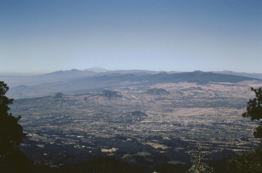
The massive Chichinautzin volcanic field extends over an 88 km E-W area immediately south of Mexico City. The Sierra Chichinautzin, formed primarily of overlapping small cinder cones and shield volcanoes, creates a broad topographic barrier at the southern end of the Basin of Mexico that extends from the E flank of Nevado de Toluca to the W flank of Iztaccíhuatl. The volcanic field contains more than 220 Pleistocene-to-Holocene monogenetic vents. The best-known eruption occurred about 1,670 radiocarbon years ago (400 CE) from the Xitle scoria cone, NE of the Volcán Ajusco lava dome complex, which forms the highest peak of the Sierra Chichinautzin. The Xitle eruption produced a massive basaltic tube-fed lava flow that covered agricultural lands as well as pyramids and other structures of Cuicuilco and adjacent prehispanic urban centers. The southern part of Mexico City and the National University of México lie atop the distal end of the 13-km-long lava flow.
Ringkasan Wikipedia
Ringkasan InggrisThe Sierra Chichinautzin volcanic field, also known as El Pedegral, is located in the Trans-Mexican Volcanic Belt, approximately 350 kilometres (220 mi) from where the Cocos Plate subducts beneath the North American Plate.
Wikipedia · CC BY-SA · Baca artikel lengkap →
Riwayat letusan
8 tercatatGlosariumGaris waktu rinci
- 399 (±149 tahun)VEI 3Perkiraan geologi399 – akhir tidak diketahuiXitle
- 203 (±131 tahun)VEI 3Perkiraan geologi203 – akhir tidak diketahuiChichinautzin
- 2238 SM (±1413 tahun)VEI 3Perkiraan geologi2238 SM – akhir tidak diketahuiGuespalapa
- 4250 SM (±75 tahun)VEI 3Perkiraan geologi4250 SM – akhir tidak diketahuiTláloc
- 5840 SM (±500 tahun)VEI ?Perkiraan geologi5840 SM – akhir tidak diketahuiCuauhtzin
- 7340 SM (±1050 tahun)VEI 0Perkiraan geologi7340 SM – akhir tidak diketahuiCerro Tetepetl
- 7370 SM (±300 tahun)VEI 4Perkiraan geologi7370 SM – akhir tidak diketahuiTres Cruces
- 7930 SM (±500 tahun)VEI 3Perkiraan geologi7930 SM – akhir tidak diketahuiVolcán Pelado
Gunung api terdekat
Tautan eksternal
⚠ Untuk referensi saja. Bukan untuk tanggap darurat.