Antarktika · Stratovolkan
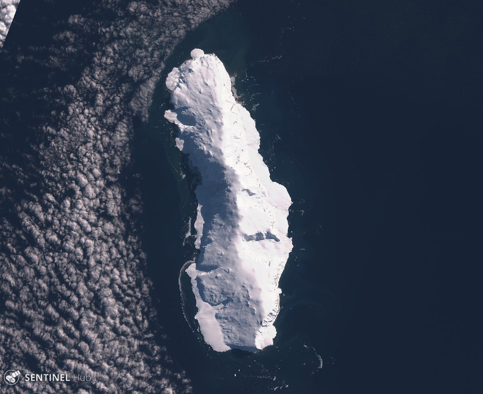
Sturge Island
- Tipe
- Stratovolkan
- Ketinggian
- 1167 m
- Letusan terakhir
- Tidak diketahui
- Tipe
- Stratovolkan
- Negara
- Antarktika
- Wilayah
- Antarktika & Scotia / Balleny Hotspot Volcano Group
- Ketinggian
- 1167 m
- Koordinat
- -67.400, 164.830
- Letusan terakhir
- Tidak diketahui
- Kondisi tektonik
- Zona rift / Kerak samudra (< 15 km)
- Bentuk lahan
- Komposit
- Batuan utama
- Trakibasal / Tefrit basanit
Ringkasan geologi
Sturge is the largest and southernmost of the Balleny Islands, which are located just off the coast of Antarctica's Victoria Land. The 44-km-long island is completely mantled by an icecap and has a prominent summit, Russel Peak, at the northern end. "Volcanic activity" was reported on a U.S. Navy chart, but no indications of present or past activity were noted in 1959 (Catalog of Active Volcanoes of the World). No detailed geologic studies have been conducted in the inaccessible Balleny Islands.
Ringkasan Wikipedia
Ringkasan InggrisSturge Island is one of the three main islands in the uninhabited Balleny Islands group located in the Southern Ocean. It lies 25 km (16 mi) southeast of Buckle Island and 95 km (59 mi) north-east of Belousov Point on the Antarctic mainland. The island also forms part of the Ross Dependency, claimed by New Zealand.
Wikipedia · CC BY-SA · Baca artikel lengkap →
Riwayat letusan
GlosariumGaris waktu rinci
Tidak ada catatan letusan.
Gunung api terdekat
Tautan eksternal
⚠ Untuk referensi saja. Bukan untuk tanggap darurat.